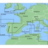
MapSource BlueChart - Irish Sea - Maps
Model: Brand: Garmin
MapSource BlueChart is Garmin's exclusive marine cartography and was developed to provide you with mapping flexibility and options you've never had before. This line of cartography products is designed to provide interactive viewing of detailed nautical chart data, thereby providing navigators with innovative object-oriented cartography. These detailed electronic nautical charts look just like paper charts when displayed on your Garmin chartplotter. Features include shading between depth contours, spot soundings, navaids, port plans, wrecks, obstructions, inter-tidal zones, and more. BlueChart offers much larger coverage areas for half the price. MapSource BlueChart Irish Sea covers British coast from Port Ellen on the Isle of Islay to Falmouth, including the Isle of Man and the Isles of Scilly; Irish coast from Sheep Haven to Caherciveen, Republic of Ireland, including Londonderry, The Storks, Belfast, and Dublin. « less
Product Specification
-
General
Product Type: MapsDistribution Media: Garmin Data CardFirst Seen On Google Shopping: January 2006 -
Compatibility Information
Designed For: Garmin GPSMap 172C, 176, 176C, 178C, 178C Sounder, 182, 182C, 188 Sounder, 188C Sounder, 196, 2006, 2006C, 2010, 2010C, 2106C, 2110C, 2206C, 2210C, 232, 238 Sounder, 276C, 292C, 296, 298C, 3006C, 3010c, 3205C, 3206C, 3210C, 376C, 392C, 396C, 492C, 498C -
Universal Product Identifiers
Part Numbers: 010-C0073-00, Irish Sea
Related Products
-
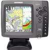
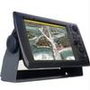
700 Series 788ci Combo NVB - Marine Chartplotter - 5" color - 640 x 640
-
C97 Multifunction 9" Display with Sonar - US Coastal Charts T70021 c44326
-
Radar 5215 Package with GMR18 4KW Radome
-
190 Marine Navigation LIGHTrule Lights Shapes
-
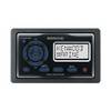
KCA RC107MR Marine CD receiver remote control unit
-
Adjustable Tilting/Swiveling Wall Mount Bracket for LCD LED Plasma - Corner Friendly (Max 125Lbs, 32~60inch) (REV.2.0)
-
Sea Water Strainers, Flushing, Bronze, 3/4"
-
122 Marine Navigation ChartKit Plotter
-
4ft 28AWG High Speed HDMI Cable w/Ferrite cores - Black
-
NavNet 3D Color 12.1" LCD Multifunction Display
-
Air Marine Tower Hardware Kit
-
Auto Glide CANBUS#2 GPS-NMEA 2000 Network Adapter Cable Assembly