MapSource BlueChart - Ligurian Sea, Corsica and Sardinia - Maps
Model: Brand: Garmin
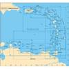
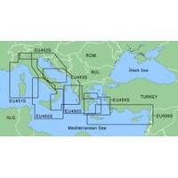
MapSource BlueChart is Garmin's exclusive marine cartography and was developed to provide you with mapping flexibility and options you've never had before. This line of cartography products is designed to provide interactive viewing of detailed nautical chart data, thereby providing navigators with innovative object-oriented cartography. These detailed electronic nautical charts look just like paper charts when displayed on your Garmin chartplotter. Features include shading between depth contours, spot soundings, navaids, port plans, wrecks, obstructions, inter-tidal zones, and more. BlueChart offers much larger coverage areas for half the price. MapSource BlueChart Ligurian Sea, Corsica and Sardinia provides detailed coverage from Ile du Levant, France to Lido di Ostia, Italy, including complete coverage of Corse and Sardegna. It also includes detailed coverage of Lago Maggiore, Lago D' Iseo, and Lago di Garda in Northern Italy. « less
Product Specification
-
Compatibility Information
Designed For: Garmin eTrex Legend Cx, Vista Cx Garmin GPSMAP 60CSx, 60Cx, 76CSx, 76Cx -
Universal Product Identifiers
Part Numbers: 010-C0438-00, Ligurian Sea, Corsica and Sardinia -
General
Product Type: MapsDistribution Media: microSD Memory CardFirst Seen On Google Shopping: January 2006
Related Products
-
Package(e97 with USA Coastal Chart, 4KW 18 Inch Digital Radome & Radar Cable)
-
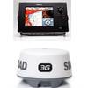
JMA-3340-6HS Radar 10KW 72 nm, 6 ft Open Array with 27-48 rpm Radar Antenna
-
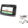
NSS8 Navigation Pack - NSS8 3G Radar
-
Max AN-M203 W51 Yellow Sea to Malaya-MAX
-
A28 Imray Guadeloupe Marine Nautical Chart
-
Bronze Seacock, 1 1/4 Inch Adapter, Straight 0835007PLB
-
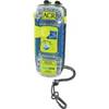
ACR2882 ACR AquaLink PLB350B
-
Cat6a Ethernet Cable | 3ft | Blue | Network | 10 Gigabit
-
Network cable - CAT 6 - RJ-45 - M - Unshielded twisted pair (UTP) 10 ft - Black
-
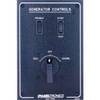
Paneltronics 9982301B Standard 120/220V AC Ship to Shore Selector
-
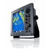
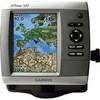
GPSMAP 521 - Marine Chartplotter - 5" color - 234 x 320
-
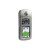
GPSMAP 76CS - Marine, hiking GPS receiver - 2.6" color - 160 x 240