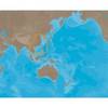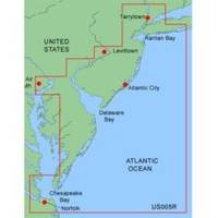
MapSource BlueChart - New York - New Jersey - Maps
Model: Brand: Garmin
MapSource BlueChart is Garmin's exclusive marine cartography and was developed to provide you with mapping flexibility and options you've never had before. This line of cartography products is designed to provide interactive viewing of detailed nautical chart data, thereby providing navigators with innovative object-oriented cartography. These detailed electronic nautical charts look just like paper charts when displayed on your Garmin chartplotter. Features include shading between depth contours, spot soundings, navaids, port plans, wrecks, obstructions, inter-tidal zones, and more. BlueChart offers much larger coverage areas for half the price. MapSource BlueChart New York - New Jersey offers coverage of Raritan Bay to Norfolk, includes Tarrytown to Fire Island Inlet, entire New Jersey coastline, Delaware Bay, Delaware River, C&D Canal, Chincoteague Bay and Newport News. « less
Product Specification
-
General
Product Type: MapsDistribution Media: microSD Memory CardFirst Seen On Google Shopping: January 2006 -
Compatibility Information
Designed For: Garmin eTrex Legend Cx, Vista Cx Garmin GPSMAP 60CSx, 60Cx, 76CSx, 76Cx -
Universal Product Identifiers
Part Numbers: 010-C0340-00, New York - New JerseyGTIN: 00753759055691
Related Products
-
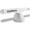
Pedestal for Gmr404 & 406 Arrays Arrays, 20 1/2"W x 12 3/4"H
-
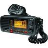
UM415BK Oceanus D Marine Radio (Black)
-
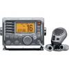
m504a-63 Submersible Plus Class D DSC VHF Marine Radio Gray
-
AS-M001 C-Card Format Gulf of Thailand - Yellow Sea
-
PAPR06; Region 6 Paper Chart Kit
-
Hydrographical Surveying: A Description of the Means and Methods Employed in Construcing Marine Charts [Book]
-
NMEA1 Trim Tab Indicator Kit, NMEA
-
E86001 2 Meter PC Serial Data Cable
-
100ft 18AWG CL2 Rated 2-Conductor Loud Speaker Cable (for
-
Drain Plug Black
-
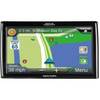
RoadMate RV 9145-LM - Automotive GPS receiver - 7" color - 800 x 480 - widescreen
-
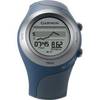
Forerunner 405CX - Running GPS receiver - Monochrome - 124 x 95