Marine Navigation: Celestial and electronic [Book]
Product Specification
-
Authors: Richard R. HobbsPages: 322Format: hardbackPublication Date: December 1, 1974Key Terms: celestial navigation, Nautical Almanac, celestial horizon, celestial sphere, sky wave, Polaris, Canopus, U.S. Navy, latitude, longitude, fathometer, Loran, celestial equator, Decca, Corr, NAVSAT, Greenwich meridian, interpolation, slave station, Starfinder
-
Universal Product Identifiers
ISBN: 0870213652GTIN: 09780870213656
Related Products
-
SP-80R Autopilot with 18 Cu Inch Pump & Rotary Feedback for Inboard Outboard & Sterndrive c10442
-
GP-150D GPS Navigator w/Differential
-
CP450C ClearPulse Chirp Sonar Sounder Module
-
XN10A/3.5 3.5" Open Array Antenna
-
HX300 Handheld VHF Radio with USB Charger
-
BlueChart g2 Vision - Adriatic Sea, South Coast - Maps
-
1447 3ft Optical Toslink 5.0mm OD Audio Cable
-
USB 3.0 | Extension Cable | 10ft | Type A | Male/Female | Black
-
Hook & Loop Fastening Cable Ties 6inch, 100pcs/Pack - White
-
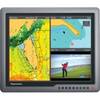
G190 Marine Display 19" 31588
-
18 8076 Fuel Connector for Mercury/Mariner Outboard Motors
-
GPSMAP 4208 Network Bundle Includes GSD22 & Gxm51