Marine World Chart of Nicolo de Canerio Januensis 1502 Circa a Critical Study [Book]
Model: 1502 Brand:
This is a reproduction of a book published before 1923. This book may have occasional imperfections such as missing or blurred pages, poor pictures, errant marks, etc. that were either part of the original artifact, or were introduced by the scanning process. We believe this work is culturally important, and despite the imperfections, have elected to bring it back into print as part of our continuing commitment to the preservation of printed works worldwide. We appreciate your understanding of the imperfections in the preservation process, and hope you enjoy this valuable book. « less
Product Specification
-
Authors: Edward Luther StevensonPages: 154Format: paperbackPublication Date: 2010.05
-
Universal Product Identifiers
ISBN: 114945458XGTIN: 09781149454589
Related Products
-
E15023 Smart Control Wireless Remote W Repeater
-
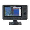
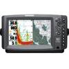
E127 Multifunction 12" Display with Sonar - US Inland Charts T70057 c44354
-
Package(c127 with aus, NZ, S. America, Asia Chart, 4KW 18 Inch Digital Radome & Radar Cable)
-
Mini RE-1 Radar engine 2KW 24km 11" 41405
-
NA-C205 C-Card Format - Fundy Nova Scotia Pei Cape Br
-
PAPR07; Region 7 Paper Chart Kit
-
Chart Master Pro Combo - Internal Antenna U1-CHRT-PROI
-
75ft Premium Optical Toslink Cable w/ Metal Fancy Connector
-
595 50ft S-Video Svideo M/F Extension Cable
-
PL-259-G Standard Marine Radio - Antenna Connector
-
6828 Marine Ground Plug Valve, 1/4 In, Brass
-
900 Series 957c Combo CHO - Marine Chartplotter - 8" color - 800 x 480 - widescreen