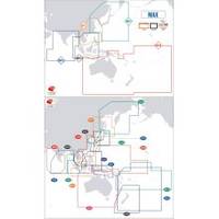
Max Chart for New Zealand in SD Format, M-AU-M001
Model: M-AU-M001 Brand: C-Map
Coverage of New Zealand and Pacific Island's cover's Campbell Island - Cooke Strait - Lake Taupo - New Plymouth - Whangaroa Harbour - West Samoa - Phoenix Island - Papeete,French Polynesia and Cook Island's
Product Specification
-
Universal Product Identifiers
Part Number: AU-M001
Related Products
-
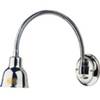
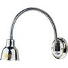
Ocean Chart Lamp, Small
-
Marine Lighting, LED, Bulkhead Mount, Ocean Chart Lamp, 10 - 30V DC, Small, Stainless Steel Finish, Warm
-
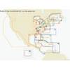
St. Lucie Inlet to Lake Pontchartrain: NT+ Wide Coverage by C-Map
-
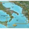
BlueChart g2 Vision - Adriatic Sea, South Coast - Maps
-
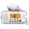
M412 11 Fixed-Mount 25W VHF Marine Radio with Class D DSC (b
-
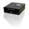
Marinenav Leviathan Marine Navigation PC Computer LEV-017R-AMD
-
409030-1 386ci Combo
-
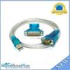
USB to RS232 DB9 male(Serial) / DB25 Male Converter Cable
-
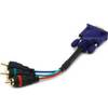
6025 6inch VGA to 3 RCA Component Video Cable (HD15 - 3-rca)
-
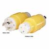
81A 15/20A Straight Blade to 30A Locking Adapter
-
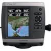
GPSMAP 521s - Marine Chartplotter - 5" color - 234 x 320
-
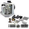
115V Seawater and Air Distribution Kit for 12,000 BTU Units