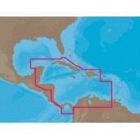
NA-C502 Furuno FP Format Western Caribbean S
Model: NA-C502 Brand: C-Map
NA-M320 => Passamaquoddy Bay to Cape LookoutCoverage includes offshore bathymetric details from Passamaquoddy Bay, ME to Cape Lookout, NC. Coverage extends from the coastline out to the Atlantic Canyons - Hudson, Baltimore, Oceanographer and others. Fishing Contour Charts do not include coastal navigational features and are recommended for offshore fishing only. « less
Product Specification
-
Universal Product Identifiers
Part Numbers: 20172, 31356, CMANAC502FP, NA-C502, NA-C502FURUNOFP, NA-M320-SD, NA-M320SDCARDGTIN: 00686074003835
Related Products
-
E15023 Smart Control Wireless Remote W Repeater
-
Inked Photography Series Kick Drumhead 24 Inch Boat Props
-
K10-00012-06 GMR 404 XHD 4KW Pedestal & 4ft Open Array
-
MapSource BlueChart - Adriatic Sea, South Coast - Maps
-
HX300 Handheld VHF Radio with USB Charger
-
0363DP0PLB Plug Garboard Drain 3/4in
-
9502 Low Pro 3 Cat II EPIRB Mounting Bracket
-
50ft 24AWG Cat5e 350MHz UTP Bare Copper Ethernet Network Cable - White
-
15ft 14AWG Power Cord Cable w/ 3 Conductor PC Power Connector Socket (C13/5-15P) - Black
-
Marine -10710-3 Slat Rail Connectors
-
1ft 24AWG Cat6 550mhz UTP Ethernet Bare Copper Network Cable - Green
-
FCF-12000 Feel Cool Fast Marine Air Conditioner by Webasto