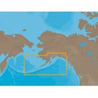
NA-C802 Furuno FP Format Gulf of Alaska
Model: NA-C802 Brand: C-Map
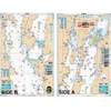
With are Electronic Sharts C-Maps we have: Olympia, Washington to Port Mcneill, British Columbia. Nannose to Victoria to Cape Scott Texada Island to Caamano Sound Cape Caution to Portland Canal Banks Island, British Columbia to Sumner Strait, Alaska Dixon Entrance to Icy Bay Gulf of Alaska Western Alaska NA-C802 Gulf of Alaska NT+ Cartography NT+ electronic charts feature much wider coverage areas at substantially lower prices. « less
Product Specification
-
Universal Product Identifiers
Part Numbers: 20185, NA-C802, NA-C802FURUNOFPGTIN: 00686074002258
Related Products
-
CH270BB/224 180 kHz Black Box Searchlight Sonar System. Includes 250mm Travel Hoist and Operates at 24 and 32VDC
-
6850 Vision Series Modular System Mounting Plate
-
Package(c125 with aus, NZ, S. America, Asia Chart, 4KW 18 Inch Digital Radome & Radar Cable)
-
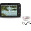
C97 9" Display w/ Sounder and US Coastal Charts
-
Lake Champlain Fishing North - Waterproof Charts
-
Adventure Medical 0115-3000 Kit Marine 3000
-
Instrument Package - for Harley-Davidson Fairing models 1996-2003 - Blue LED - MCL-3000-OT
-
Cat6a Ethernet Cable | 15ft | Yellow | Network | 10 Gigabit
-
USB 3.0 | Extension Cable | 10ft | Type A | Male/Female | Black
-
Medium Deck Seal SS Connector 1.18 Cable .55
-
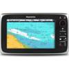
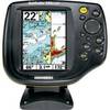
500 Series 595c Combo - Marine Chartplotter - 5" color - 240 x 320
-
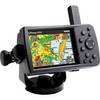
GPSMAP 376C - Marine GPS receiver - 3.8" color - 480 x 320