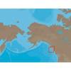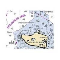
NOAA Int Footl/N Pac Ocean/Bering Sea-South
Dept. of Commerce - 513; NOAA nautical charts Encompasses the Pacific Ocean - U.S. Coast Note: Ensure that your charts are kept current to reflect changes to that area
Product Specification
-
Universal Product Identifiers
Part Number: 513
Related Products
-
Package(e127 with USA Coastal Chart, 4KW 18 Inch Digital Radome & Radar Cable)
-
NA-C705 Furuno FP Format Banks Is BC Sumner Strait AK
-
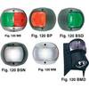
European Style Navigation Lights, Red Side Light, Black Perko
-
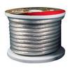
Raptor - BC4S100 - 4-Gauge Battery Cable - Silver 100' Spool
-
Coaxial Cable Assembly, 20ft Coaxial Cable Assembly Sea-Dog Line
-
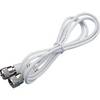
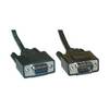
Serial cable - (DB-9) - M - (DB-9) - F - 6 ft - PC
-
/ Quicksilver 22-860382 Connector Speedo
-
/ Quicksilver 22-18922 Oil Reservoir Connector
-
Marine Power 441220 Adapter Plate 262 Holley
-
YETP5E-7 7ft 24AWG Cat5e 350MHz UTP Bare Copper Ethernet Network Cable - Yellow
-
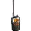
MRHH 125 Marine VHF Radio
-
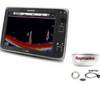
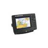
GlobalMap 6600C HD - Marine GPS receiver - 7" color - 640 x 480