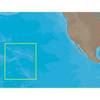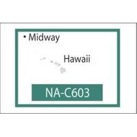
NT+ NA-C603F The Hawaiian Islands
Model: NA-C603F Brand: C-Map
C-MAP has set the standard for electronic charts with five consecutive NMEA awards for Best Electronic Cartography. The spring 2004 C-MAP NT+ release will include marina detail for over 1,000 US marinas in C-MAPs private collection. Now you will be able to see slip detail as well as the locations for onshore facilities. Finding the right chart plotter for you is easy with 17 manufacturers powered by C-MAP. Just look for the NT+ logo. « less
Product Specification
-
Universal Product Identifiers
Part Number: NA-C603.FGTIN: 00686074002272
Related Products
-
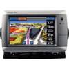
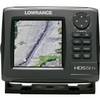
GPSMAP 740 GPS Chartplotter with Internal GPS Antenna 010-00835-02
-
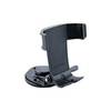
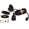
Marine Mount - GPS receiver marine mount bracket
-
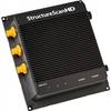
000-10801-001 LSS-2 StructureScan HD Sounder W O Transducer
-
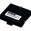
AISBLACKBOX - Assists in Monitoring, Management and Collision P
-
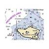
NA-C603 C-Card Format Hawaiian Islands
-
Hecate Strait-Etollin Island Chart
-
Max Wide North America & South America C16996
-
TS200-30 Temperature Probe f/SST-110 Thru-Hull
-
000-10520-001 HDS-5m Gen2 Nautic Insight Chartplotter
-
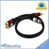
1.5ft Premium 2 RCA Plug/2 RCA Plug M/M 22AWG Cable - Black
-
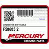
F58685-2 - Connector , NLA Mercury Marine
-
PT-WSBL Portable Mount Transducer Blue Connector wptwsbl