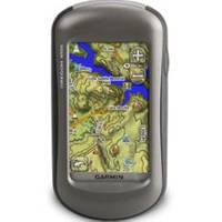
Oregon 450T Handheld GPS with Topo US Maps c38059
Model: 450T Brand: Garmin
Tap the touchscreen then hit the trail with Oregon 450t. This next-generation handheld features a rugged, touchscreen along with preloaded topographic maps, 3-D map views, a high-sensitivity receiver, barometric altimeter, electronic compass, micro - SD card slot, picture viewer and more. Even exchange tracks, waypoints, routes and geocaches wirelessly between similar units. Touch and Go Oregon 450t leads the way with a tough, 3" (7.62 cm) diagonal, sunlight-readable, color, touchscreen display that offers crystal clear enhanced colors and high-resolution images. Its easy-to-use interface means youll spend more time enjoying the outdoors and less time searching for information. With user-selectable dashboards, you can customize the appearance of your display. Both durable and waterproof, Oregon 450t is built to withstand the elements: bumps, dust, dirt, humidity and water are no match for this rugged navigator. Explore Backcountry in 3-D Oregon's preloaded U.S. or European topographic maps, 3-D map view and a built-in worldwide basemap with shaded relief give you all the tools for serious climbing or hiking. Map detail includes national, state and local parks and forests along with terrain contours, elevation information, trails, rivers, lakes and points of interest. Just in case youre wondering how steep that hill really is, Oregons 3-D map view helps you visualize your surroundings giving you a better perspective of the elevation. Get Your Bearings Oregon 450t has a built-in 3-axis tilt-compensated electronic compass, which shows where you're heading even when youre standing still, without holding it level. Its barometric altimeter tracks changes in pressure to pinpoint your precise altitude, and you even can use it to plot barometric pressure over time, which can help you keep an eye on changing weather conditions. See changes in your elevation ahead of you and where you've been with enhanced track navigation. With its high-sensitivity, WAAS-enabled GPS receiver and Hot - Fix satellite prediction, Oregon 450t locates your position quickly and precisely and maintains its GPS location even in heavy cover and deep canyons. Share Wirelessly With Oregon 450t you can share your waypoints, tracks, routes and geocaches wirelessly other compatible Oregon, Colorado and Dakota users. Now you can send your favorite hike to your friend to enjoy or the location of a cache to find. Sharing data is easy. Just touch send? to transfer your information to similar units. Add Maps Adding more maps is easy with Garmin's wide array of detailed topographic, marine and road maps. With its micro - SD card slot, Oregon 450t lets you load TOPO U.S. 24K maps and hit the trail, plug in Blue - Chart g2 preloaded cards for a great day on the water or City Navigator map data for turn-by-turn routing on roads (see maps tab for compatible maps). Oregon 450t also supports Birds - Eye Satellite Imagery (subscription required), that lets you download satellite images to your device and integrate them with your maps. Find Fun Oregon 450t supports Open - Caching.com GPX files for downloading geocaches and details straight to your unit. By going paperless, you're not only helping the environment but also improving efficiency. Oregon stores and displays key information, including location, terrain, difficulty, hints and descriptions, which means no more manually entering coordinates and paper print outs! Simply upload the GPX file to your unit and start hunting for caches. Show off photos of your excursions with Oregons picture viewer. Slim and lightweight, Oregon is the perfect companion for all your outdoor pursuits. Oregon 450t: Touch the great outdoors. Physical & Performance: Unit dimensions, WxHxD: 2.3" x 4.5" x 1.4" (5.8 x 11.4 x 3.5 cm) Display size, Wx - H: 1.53"W x 2.55"H (3.8 x 6.3 cm); 3" diag (7.6 cm) Display resolution, Wx - H: 240 x 400 pixels Display type: transflective color TFT touchscreen Weight: 6.8 oz (192.7 g) with batteries Battery: 2 AA batteries (not included); Ni - MH or Lithium recommended Battery life: 16 hours Waterproof: yes (IPX7) Floats: no High-sensitivity receiver: yes Interface: high-speed USB and NMEA 0183 compatible Maps & Memory: Basemap: yes Preloaded maps: yes (topographic) Ability to add maps: yes Built-in memory: 850 MB Accepts data cards: micro « less
Product Specification
-
Universal Product Identifiers
Part Number: c38059
Related Products
-
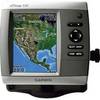
C97 Multifunction 9" Display with Sonar - European Charts T70023 c44025
-
kv8715 Floating VHF Marine Radio
-
Seasense 50031802 Lighter/Chart Light Chrome
-
41500-7 Series 41 12V 10W Stern
-
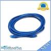
25ft 24AWG Cat6a 500mhz Stp Ethernet Bare Copper Network Cable - Blue
-
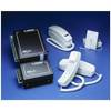
C-Phone Kit - Includes Master Control Unit, 2 Handset Kits & 100' of Wire
-
14ft 24AWG Cat5e 350MHz UTP Bare Copper Ethernet Network Cable - Blue
-
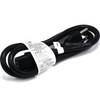
3ft 14AWG Power Cord Cable w/ 3 Conductor PC Power Connector Socket (C13/5-15P) - Black
-
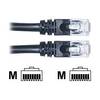
Network cable - CAT 6 - RJ-45 - M - Unshielded twisted pair (UTP) 75 ft - Black
-
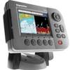
GPSMAP 530s - Marine GPS receiver - 4" color - 240 x 320
-
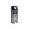
GPS 72 - Marine, hiking GPS receiver - Monochrome - 120 x 160
-
E62186 - A50D 5 Combo, Int GPS, w/o Charts