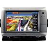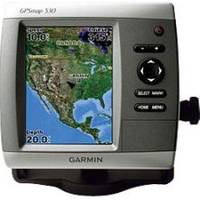
GPSMAP 530s - Marine GPS receiver - 4" color - 240 x 320
Model: 530s Brand: Garmin
The slim-line fresh water GPSMAP 530s flush-mounts easily in your boat and sports preloaded, detailed maps for U.S. inland lakes. The 530s also features a 5" QVGA display and simple, straightforward buttons and menus. You can add the optional BlueChart g2 Vision SD card for even more enhanced features. The 530s comes preloaded with detailed maps for U.S. inland lakes, including 5300 lakes with shoreline, depth contours, and more. Over 300 of these lakes are enhanced with extra Inland Lakes Vision features. For areas outside the U.S., the 530s has a worldwide basemap with satellite images in place of more traditional maps. The SD card slot makes it easy to add additional maps without connecting to a computer. And with just a few buttons and a simple, intuitive interface, the 530s makes navigating your way through the water easy. The 530s boasts advanced Inland Lakes Vision features for 300 of the most popular lakes. 3D mariner's eye view or fish eye view provides you with a 3-dimensional perspective of map information, both above the waterline and below it. Higher-resolution satellite images help you orient yourself in unfamiliar areas. Auto guidance technology searches through map data to suggest the best passage. The GPSMAP 530s comes with a powerful dual frequency or dual beam transducer that clearly paints depth contours, fish targets and structure. It's also CANet compatible, so you can share sounder data with another chartplotter on your boat. « less
Product Specification
-
General
Product Type: GPS receiverRecommended Use: MarineReceiver: 12 channelCard Reader: SD Memory CardInterface: NMEA 0183Included Software: MapSource BlueChart Inland Lakes: United StatesCompatible Software: BlueChart g2 VisionSBAS: WAASDGPS: DGPS readyAntenna: Built-inAccuracy: Position - 49 ft Velocity - 0.16 ft/sec Position - 10 ft ( with WAAS )Update Rate: 1/secondFeatures: Depth sounder, alarm, 2D / 3D map perspectiveFirst Seen On Google Shopping: March 2007 -
Display
Type: LCD - colorDiagonal Size: 4"Resolution: 240 x 320Features: Adjustable brightness -
Acquisition Times
Warm: 15 secCold: 45 sec -
Navigation
Waypoints: 1500Tracks: 20Tracklog Points: 10000Routes: 20Trip Computer: Sunrise/sunset times, sun/moon positions -
Connections
Interfaces: Antenna -
Miscellaneous
Design Features: Rugged caseProtection: WaterproofWaterproof Standard: IPX7Included Accessories: Transom mount transducer, protective cover, mounting bracket, power/data cable -
Dimensions & Weight
Width: 5.9 inDepth: 2.9 inHeight: 6.4 inWeight: 1.8 lbs -
Environmental Parameters
Min Operating Temperature: 5 °FMax Operating Temperature: 131 °F -
Universal Product Identifiers
Part Numbers: 010-00613-00, 530sGTIN: 00753759065959
Related Products
-
ICE 45 - Fishfinder - portable - included transducer : XI 9 19 - dual-beam
-
GPSMAP 740 GPS Chartplotter with Internal GPS Antenna 010-00835-02
-
International Radar Mounting Platform Small 975-1111
-
BlueChart g2 Vision - Southern Gulf of Mexico - Maps
-
Max AN-M204 W52 Japan and Hokkaido-MAX
-
Orca Green Marine LED Tri-Color Anchor / Strobe Navigation Light
-
T70015 SPX-5 Wheelpilot Pack w/p70 Control Head
-
70 Allround Red Nav Light
-
3ft USB 2.0 A Male to Micro 5pin Male 28/24AWG Cable w/ Ferrite Core (Gold Plated)
-
Idc34 x 4 / CE34 x 2, 46 Inch Floppy Cable 2104-646
-
10.0 Sbeg Generator
-
Barbour Air Cooled Power Plate PB100134