Sea Charts of the British Isles: A Voyage of Discovery Around Britain & Ireland's Coastline [Book]
Sea Charts of the British Isles takes the reader on a voyage through the seaports, fishing and commercial harbors, naval bases and dockyards, and sea-side havens that have always supported local life in Britain and contributed to the Isles’ defense. This beautiful collection of charts contains a wealth of information about Britain’s maritime history, as well as the history of charting and surveying. The great names in British chart-making are all included, from Captain Greenvile Collins and Professor Murdoch Mackenzie to Graeme Spence and William Bligh. « less
Product Specification
-
Authors: John Blake, Lie, John Blake (Lieutenant Commander.)Pages: 128Format: hardbackPublication Date: November 19, 2005Key Terms: British Crown Copyright, Trinity House, Royal Navy, British Library, Scotland, British Isles, Admiralty, River Tyne, portolan charts, compass rose, Portland Bill, Pembrokeshire, South Ronaldsay, Isle of Wight, Lowestoft, River Thames, King's Lynn, Pentland Firth, Firth of Clyde, English Channel
-
Universal Product Identifiers
ISBN: 1844860248GTIN: 09781844860241
Related Products
-
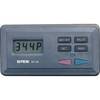
SP-80MS Autopilot for Cable Steer Straight Helms st80ms
-
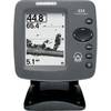
300 Series 323 - Fishfinder - included transducer : XNT-9-20-T - dual-beam
-
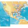
MSD/674P+ Marine Map - North America - United States of
-
9521 Floating Pouch f/ResQLink
-
Bulk cable - CAT 6 - Unshielded twisted pair (UTP) 1000 ft - Red
-
McMurdo Fastfind Max G PLB with Built in GPS XXXXXXXX
-
Marine Navigation: Piloting [Book]
-
Marine Navigation Workbook: Piloting and Celestial and Electronic Navigation [Book]
-
DB9 Male / DB25 Male, 9c, 6 ft Molded (UL)
-
Molded Marine Connector 2 Conducter Seachoice 13801
-
1614g 14 100 Pcs Ring Heat Shrink Connector Blue
-
TNC-Cp/Gs-02 Connector for RG-8X Cable tncpgs