Waterproof Chart Kit - Cape Ann Mass. to Portalnd, Maine
Model: Brand: Maptech
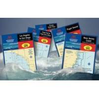
Waterproof Charts w/ Companion CD WPB0230 230: Cape Ann Mass. to Portland, Maine Northern Massachusetts and the New Hampshire Seacoast to Casco Bay. 23 chart pages, 73 GPS waypoints, Lat. /Long. grids, courses, ramps, and 130 facilities. 12 x 17, scales 1:1,200,000 to 1:26,000. Product Overview These easy-to-use, compact chart books are ideal for Day-Sailors, Fishing Boats, and Trailer Boats. They measure 12 x 17 (24 x 17 when open) and are made of waterproof, tear-resistant synthetic paper that will withstand the elements. GPS Ready New features make Waterproof Chartbooks easy to use with your GPS. Most charts include one-minute lat./long. grids to make vessel positioning a breeze, and major navigation aids are identified with named GPS waypoints. Small and Large-Scale Charts Waterproof Chartbooks include small-scale, wide area charts as well as large-scale, detailed charts of harbors and appro « less
Product Specification
-
Universal Product Identifiers
Part Number: WPB0230
Related Products
-
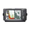
C97 Multifunction 9" Display with Sonar - US Coastal Charts T70021 c44326
-
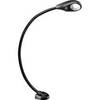
Marine Flexible LED Chart Table Lamp 9353723
-
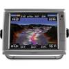
900 Series 957c Combo - Marine Chartplotter - 8" color - 800 x 480 - widescreen
-
010-00749-01 - GPSMAP 7212, 12 Tchscrn MFD, Coast Map
-
Canadian Charts Juan de Fuca Strait to Dixon Entrance Chart
-
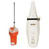
JQE-103 EPIRB System
-
Prod 1.5oz Refill Air Horn 46201
-
Elite 5 5" 83/200kHz Chartplotter/Fishfinder
-
4043 100ft 18AWG CL2 Rated 4-Conductor Loud Speaker Cable (for In-Wall Installation)
-
DCE/DTE DB60 Crossover Cable - 1ft
-
Guest 297 Second Station Kit for 296-5 c10821
-
000-10494-001 Elite-4 DSi Combo Base Transducer