Western U.S. Fishing Maps Sea of Cortez North Chart
Model: Brand: Fish-n-Map
FISH-N-MAP UNDERWATER TOPOGRAPHY MAPSMade of waterproof, tear resistant plastic. Features include: underwater depth contours, fish locations, latitude and longitude for GPS, multiple freshwater lakes on one map, boat ramps, recreational facilities and much more.
Product Specification
-
Universal Product Identifiers
Part Numbers: 317166, 7123GTIN: 00761428071231
Related Products
-
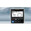
Navpilot711ob Autopilot Inboard Requires Pump
-
IR2 4.3 4KW 3.5 Foot Open Array Radar R-0005
-
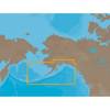
NA-C802 C-Card Format Gulf of Alaska
-
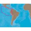
SA-C001 Furuno FP Format - Peru, P. Vallarta, P. Bolivar
-
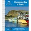
Embassy Cruising Guides - Chesapeake Bay to Florida #BKCBF-02
-
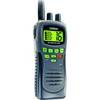
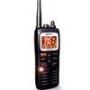
T42554 Atlantis Hand-Held VHF 2-Way Marine Radio - Black
-
Idc34 x 4 / CE34 x 2, 46 Inch Floppy Cable 2104-646
-
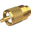
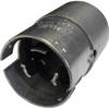
PL-259-G Standard Marine Radio - Antenna Connector
-
50M1 50 Amp - 125VAC Male Plug
-
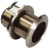
B75-20-L Broadband Chirp 20 Degree Tilt, No CONNECTOR, Depth & Temperature Thru-Hull Tilted
-
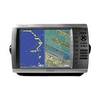
GPSMAP 4012 - Marine GPS receiver - 12.1" color - 1024 x 768
-
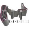
MHS125 Floating HH VHF