Chartplotters
-
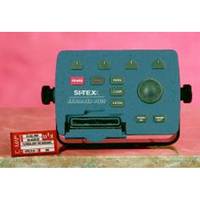
EXPLORER PLUS C-MAP MAX/NT+Charting System Control Unit
- Turns any "off-the-shelf" VGA Monitor into full function Electronic Charting System.- Available with or without 16 Ch. GPS/WAAS receiver.cmaopDescriptionThe EXPLORER PLUS turns almost any "off the shelf" PC monitor into a full-featured C-MAP electronic charting system. Couple this unique product to an existing onboard monitor or add just about any size CRT or flat panel display for a very convenient two piece charting system with unlimited mounting possibilities. Compact controller unit connects to most standard monitor with VGA input. Straightforward logic and soft key operating system offers uncanny ease of operation. Waterproof trackpad provides smooth cursor transitions to plot, scroll, pan and make menu selections. Compatible with the new C-MAP MAX charts, technically the most innovative C-MAP charts ever designed. Dual slot C-MAP MAX/NT+ cartridge doubles the charting capability. A unique programmable anti-grounding feature using 14Guardian!22 Grounding Alarm* 14provides alarms if your current course takes you within danger of shoals, obstacles or other areas where the water is too shallow for your vessel's draft. This feature helps provide an added level of security for all boaters. Available with or without GPS/WAAS sensor and with external GPS/Loran receiver for True Loran Positioning as model Explorer PlusL. Perfect for use with the optional SI-TEX GPS-20 model sensor. Position displayed when connected to GPS. Expands to an all-in-one GPS Charting System/Fishfinder/Radar with optional ES502 Fishfinder Module and optional 2kW to 4kW MDS Radar Sensors. Displays tidal data and port service information for selective areas worldwide from local C-Card. Up to 1000 Waypoints, Mark or Events and 5000 points per track. Control unit can be mounted up to 6 feet away from display unit, multiplying the mounting options on any vessel. In addition to charting information, EXPLORER PLUS numerically indicates speed, course, distance, arrival time, STG, temp and depth when interfaced with proper sensors. Charting is displayed in North-up or Course-up modes with GPS input. Controller unit is designed to be either tabletop, bulkhead or flush mounted. Special trunion bracket and mounting knobs are provided for easy installation and removal. NMEA-0183 data port for interfacing with other onboard electronics. Optional memory cards provide unlimited track and waypoint storage capability.
-
CP190i 5" ChartPlotter
-
CP390i 7" ChartPlotter
-
Elite-5m Chartplotter
-
GPSMAP 620 World Wide
-
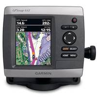
4" GPSMAP 441 Chartplotter
-
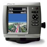
GPSMAP 546 Chartplotter
-
GPSMAP 526 Chartplotter
-
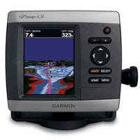
Chartplotter 431s with Dual-beam Transducer
-
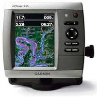
GPSMAP 536 Chartplotter
-
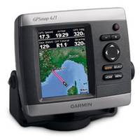
GPSMAP 421 Chartplotter
-
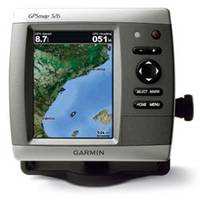
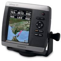
GPSMAP 521 Chartplotter, 5"
-
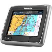
a65 Touchscreen Multifunction Display, 5.7", Europe Charts
-
a65 Touchscreen Multifunction Display, 5.7", Rest of the World Charts
-
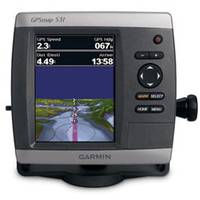
GPSMAP 531 Chartplotter, 5"
-
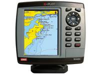
G142C G-Plot GPS Chartplotter
The GME G-Plot offers a simple to use highly featured GPS chartplotter. Incorporating a 16 channel internal GPS antenna for fast GPS updates, perspective view, animated navigation markers and plotter mode are some of the many functions of this unit.Multiple screen options are available and 6 can be 'saved to favourites' for easy access.Background world map included. The unit also has a slot for a C-Map Max(TM) SD card.
-
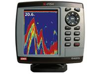
G142FD G-Fish Digital Fishfinder
The GME G-Fish is a state-of-the-art, high performance digital fishfinder, perfect for discerning fishermen wanting to find fish.The unit has automatic mode ensuring the digital technology will perform best for all conditions, with a manual override.Bottom lock, A-scope, split frequency and zoom are some of the screen configurations available.The unit comes complete with a 600 watt dual frequency (50/200 kHz) transom mount triducer, which incorporates depth, temperature and a water speed paddle wheel.
-
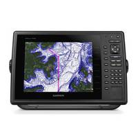
GPSMAP 1000
10" Keyed Chartplotter for Cruising, Sailing or Fishing 10 1D color SVGA display with keyed control Preloaded with worldwide basemap High-sensitivity internal 10 Hz GPS/GLONASS receiver Supports optional GCV!22 10 black box sonar that adds both DownVü and Garmin SideVü!22 scanning sonar with CHIRP technology (sold separately) Compatible with LakeVü!22 HD Ultra, BlueChart® g2 and BlueChart g2 Vision® Supports all Garmin marine radarThe 10 1D color GPSMAP 1020 keyed chartplotter has a preloaded worldwide basemap. The built-in 10 Hz GPS/GLONASS receiver updates your position and heading 10 times per second.NMEA 2000® SupportThis combo allows you to add more capabilities to your boat. It provides NMEA 2000 support so you can see valuable information on your screen for Garmin autopilot, engine data, SiriusXM Weather radar and more.Radar SupportAdd your choice of marine radar, either open array or our new xHD dome radar that pair ease of use with advanced open array features.NetworkingThe GPSMAP 1020 offers select networking capabilities that allow you to share features with other compatible GPSMAP units, such as radar, GCV 10 DownVü and SideVü scanning sonar, supplemental maps, and user data, including waypoints, routes and tracks. User data entered into one chartplotter can be automatically synced with other chartplotters in a network.Special Sailing FeaturesSupported sailing features include laylines, enhanced wind rose, heading and course-over-ground lines, true wind data fields and tide/current/time slider.GND!22 10 Black Box InterfaceThe GND 10 black box interface seamlessly integrates Nexus instruments and sensors with the Garmin family. It converts data between the Nexus network and NMEA 2000 to provide trouble-free compatibility between Nexus and Garmin products, including gWind!22 and gWind Race wind transducers.Compatible with gWind TransducersGarmin gWind, gWind Wireless and gWind Race transducers feature twin-fin technology with 3-bladed propeller. Connect to the NMEA 2000 and compatible Garmin chartplotters via the GND 10 black box bridge.Get Your Apple® Device Onboard with BlueChart® MobileWith BlueChart Mobile, a free app downloaded from the App Store!22, you can plan marine routes on your iPad® or iPhone® then wirelessly transfer them to your boat 19s compatible networked Garmin chartplotter. Even if you don 19t have a Garmin chartplotter, you can still take advantage of the tremendous features of BlueChart on your Apple device.View and Control Your Device From an iPhone or iPadGarmin Helm!22 allows you to view and control your compatible Garmin chartplotter from an iPhone or iPad 14 while providing enhanced situational awareness for the mariner. Easily switch between portrait and landscape mode to accommodate mounting preferences. Using your Apple digital mobile device, you can even record a movie of your chartplotter screen to share with friends and family. Download from the App Store today.A
-
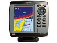
G142CFD G-Combo GPS Chartplotter and Fishfinder
G142CFD G-Combo GPS Chartplotter and FishfinderThe GME G-Combo combines all the features of the G-Plot chartplotter with the powerful dual frequency digital sonar of the G-Fish. Offering outstanding performance and incredible value.The easy to use intuitive menu means navigating around this unit is simple. It incorporates a 16 channel internal GPS antenna and digital sounder technology. This unit is perfect for the boater who wants to get there and fish.The unit comes complete with a 600 watt dual frequency (50/200 kHz) transom mount triducer, which incorporates depth, temperature and a water speed paddle wheel.
-
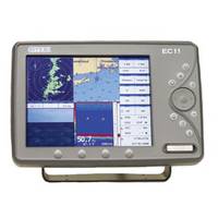
EC11 10.4 HD SVGA Color LCD
- Two composite video inputs- VGA video output- Bracket/flush mount- Available with external GPS antenna- 10,000 waypoints/marks- 50 routes of 50 waypoints each- 10,000 trackpoints- High resolution 800 x 600 display- Works with optional MDS Radar Sensor- Waterproof to IP67 standardec111DescriptionEC11 10.4 HD SVGA Color LCD Two video inputs to connect optional cameras Video output for second-station repeater capability Bracket/flush mount Specifications subject to change without notice. Standard EC Series features: Ultra-fast processor provides instant screen changes Expands to all-in-one unit with optional Fishfinder, Radar, AIS senors (Not: Radar Sensor option not available on EC5) Included GPS/WAAS reciever Use C-MAP Max SD-Cards Rotary/Track dial, backlit keys and on-screen menus for easy access to all system functions Interfaces with option DSC VHF to recieve and display position info of other vessels equipped with DSC transceiver within range Guardian!22 Programmable Anti-Grounding feature Depth Graph feature Split-screen displays SD reader North-up or Track-up modes Built-in worldwide background chart Port Info, Find Function, Tide Info GOTO and MOB functions Selectable languages Coordinates displayed in Lat/Lon, TD's, UTM or OSGB NMEA 0183 dataport for interfacing data with other on-board electronics IP67 Waterproof rating

- 1
- 2