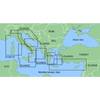
010-C1023-20 Bluechart G2 HXEU802XMediterranean Sea & Iberian
Model: 010-C1023-20 Brand: Garmin
NOTE: This preloaded Garmin microSD media is for compatible Garmin units that take microSD memory cards only. This is not for units that require the Garmin proprietary data card. Coverage features the Strait of Gibraltar, the Balearic Islands, the French Riviera, Corsica, Sardinia, Sicily, the Adriatic Sea, the Greek Islands, the Aegean Sea, the Dardanelles and Bosporus Straits, the Sea of Marmara, Cyprus, the Suez Canal, Tripoli and Algiers Harbors, and the Gulfs of Gabes and Tunisia. Also details the Atlantic side of the Iberian Peninsula from the Canary Islands to the Bay of Biscay including the Gulf of Cadiz, the Portugal coast in full, the Gulf of Gascogne, and the Madeira and Azores Islands. « less
Product Specification
-
Universal Product Identifiers
Part Numbers: 010-C1023-20, 10807253, 35817GTIN: 00753759095529
Related Products
-
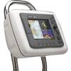
5 Instrument Pod Un-Cut GP150
-
Package(E140W, GPS Antenna, 4KW 24 Inch Digital Radome & Radar Cable )
-
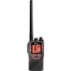
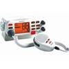
kv8715 Floating VHF Marine Radio
-
BlueChart g2 Vision - Cape Cod - Maps
-
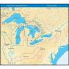
MapSource BlueChart - Adriatic Sea, South Coast - Maps
-
NT+ Wide Map, Ohio River: Cairo to Pittsburg NA-C039
-
Mr F75 Fixed Mount Marine VHF Transceiver with Tri-Watch and Pa Capability - White, MRF75
-
AP2802VRF Autopilot AP28,AC42,RC42 No Drive Unit
-
Innovative Lighting LED Deck Mount Navigation Light - Stainless Steel
-
15ft 32AWG Mini DisplayPort Cable - White
-
741 HPDB50 M/CN50 M SCSI Cable , 25pr - 6ft
-
Ethernet Category 5 Enhanced RJ45 Network Patch Cable - 3'