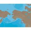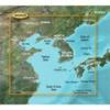
Max Lakes South NA-M019 c30549
Model: NA-M019 Brand: C-Map
NA-M019 Region 3: SOUTH Ultimate Electronic Maps for Better Freshwater Fishing and Hunting! C-Map brings new power to your plotter with MAX Lakes freshwater electronic maps. Designed for freshwater fishing and hunting, MAX Lakes delivers the highest level of detail and value-added data not found on any other electronic map on the market. Plus the MAX Lakes database is constantly growing and updated yearly! « less
Product Specification
-
Universal Product Identifiers
Part Number: c30549
Related Products
-
GP-150D GPS Navigator w/Differential
-
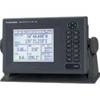
T70027 C97 Multifunction Display w/Sonar - US Inland Charts
-
LMP-2 F/ Sitex Simrad et Al Domes
-
NA-C705 Furuno FP Format Banks Is BC Sumner Strait AK
-
BlueChart g2 Vision - Yellow Sea - Maps
-
Hydrographical Surveying; A Description of Means and Methods Employed in Constructing Marine Charts [Book]
-
NAVPILOT 720 Autopilot HH Inboards No Pump
-
1550 Knife Rigging Standard S/S
-
5M Heavy Radome Cable w/Right Angle Connector - E55074
-
Inc ETS0119746 Computer Hardware
-
2ft 24AWG Cat6 550mhz UTP Ethernet Bare Copper Network Cable - White
-
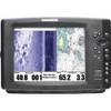
1100 Series 1197c SI Combo NVB CHO - Marine Chartplotter - 10.4" color - 800 x 600