Sailor
-
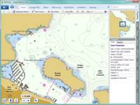
Coastal Explorer
Coastal Explorer!22 is a sophisticated and full-featured, yet very easy to use navigation software package designed specifically for the pleasure boater.With support for more charts and chart formats than any other recreational navigation system, route planning features with multi-level undo capability, integrated gazetteer and guide books, virtual instrument display, and obstacle alerts, Coastal Explorer will help you make your next cruise safer and more enjoyable."This program sets the standard for other e-charting packages."-- Mark and Diana Doyle, Mad Mariner"...one of the best designed software products I've seen."-- Aaron Tinling, Navagear"Stable, well-crafted, and loaded with fresh ideas."-- Ben Ellison, Power & MotoryachtAA FeaturesAA Display raster chartsA Display vector chartsA Chart Portfolio management toolsA Automatic chart updatesA Seamless "quilted" chart displayA North-Up, Heading-Up, Course-Up and arbitrary chart orientationA Document based route and mark managementA Advanced voyage planning toolsA Unlimited routesA Unlimited waypointsA Unlimited range/bearing linesA Unlimited boundary circles, lines, and areas with alarmsA Unlimited undo and redoA Simulated Navigation ("dead reckoning" mode)A Superior route manipulation toolsA Route obstacle detectionA GPS NavigationA Transfer routes, marks, and tracks to/from GPS and other programsA GPX file import and exportA Record tracks and eventsA Scaled vessel display (for own-ship and AIS targets)A Powerful searchingA Integrated US Coast Pilot information and NGA Sailing Directions EnrouteA Coastal Explorer Network Community Guide BookA ActiveCaptain Interactive Cruising GuidebookA Atlantic Cruising Club Guide to MarinasA Panoramio Photos of the WorldA Tide and Current PredictionsA Text Weather ForecastsA Graphical Weather ForecastsA GRIB File DisplayA Data Buoy and METAR Weather ObservationsA NAVTEX Message Display (requires NAVTEX receiver)A Online Ship's LogA Split screen configurationsA Customizable Full-Screen Cruise ModeA Save customized screen configurations for quick accessA Day, Dusk, and Night Display ModesA Customizable instrumentation displayA Analog-style and digital instrument displaysA Full Screen Planning Mode optionA Supports multiple GPS receivers and other sensorsA Autopilot controlA Depth sounder supportA Wind and weather sensor supportA AIS Vessel DisplayA AIS Dead-ReckoningA RADAR Target DisplayA DSC Position Report DisplayA Radar overlay optionA Video camera supportA Integrated Help systemA Product support via emailA Online support forumA Telephone support lineAA9AChart CompatibilityAA C-MAP MAX/PC by JeppesenA NOAA RNC ®A NOAA ENC ®A US Army Corps of Engineers IENCA Admiralty AVCSA ChartWorldA Canadian Hydrographic Service Digital ChartsA NV. ChartsA ENC (S-57/S-63)A BSB Versions 1-5A Maptech RML and PCXA SoftChart and PhotoChartAADevice CompatibilityAInterfacesAA NMEA 0183 and NMEA 0183-HSA NMEA 2000 ® via Rose Point NMEA 2000 USB Gateway, Actisense NGT-1, or Maretron USB-100A Garmin Binary Interface (serial and USB)A Standard PC Communications (COM) PortA Raw NMEA 0183 over TCP/IP portAAVideo InputAA Any DirectShow compatible video sourceA AXIS Network Video Cameras and ServersA Linksys Wireless Network Video CamerasA Any standard MotionJPEG compatible network video sourceAANAVTEX InterfacesAA NMEA 0183 NAVTEX InterfaceA Raw NAVTEXA NASA Marine PC Navtex USBAASystem RequirementsAA PC with Microsoft Windows XP, Windows Vista, Windows 7, Windows 8, or later compatible operating system (32-bit or 64-bit)A 500 MB or more available hard drive space (actual requirements depend on installation options)A CD-ROM drive for program installationA DVD-ROM drive for chart installationA Super VGA (800x600) or higher resolution monitor, 1024x768 or higher is recommendedA NMEA 0183, NMEA 2000, or Garmin compatible GPS and/or other marine electronics with an appropriate PC interfaceA Internet access required for some features
-
Connection Cable XLPE 20M
Sailor Connection Cable XLPE 20M
-
GMDSS Connection Cable 3000
Sailor GMDSS connection cable Sailor 3000 50m
-
-
GMDSS Connection Cable 3026
Sailor GMDSS connection cable 3026 5m and 10m.
-
N163S Power Supply 110/220V AC
Sailor N163S Power Supply 110/220V AC
-
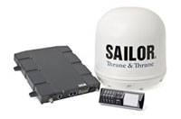
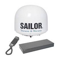
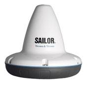
150 FleetBroadBand
Sailor 150 FleetBroadBand offering service on Inmarsat’s global broadband I4 satellite coverage, SAILOR 150 FleetBroadband is a competitive, high quality single-user solution for professional vessels, such as workboats or fishing vessels, and is also perfectly suited for use on recreational boats, both sail and power.
-
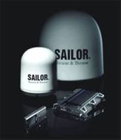
250 FleetBroadBand
Sailor 250 FleetBroadBand harnesses the flexibility of Inmarsat’s next I-4 satellite service, FleetBroadband. Sailor 250 FleetBroadBand offers budget conscious fishing vessels, workboats and private yachts the opportunity to enter the broadband arena whilst providing the reliability and functionality expected of systems for large commercial vessels.
-
Fleet33 Satellite Phone
Sailor Fleet33 is the most reliable communication solution for fishing vessels, workboats, medium sized yachts and sailing boats. Sailor Fleet33 offers proven technology for reliable voice telephony, fax, e-mail and Internet all over the world – with exception for the Poles. On Sale While Supplies Last!!!
-
3026C Mini-C GMDSS-SOLAS Antenna
Sailor 3026C Mini-C GMDSS-SOLAS Antenna 4th Inmarsat-C GMDSS generation from Thrane & Thrane. The SAILOR TT-3000E mini-C GMDSS System has been developed to meet market requirements for reliable & stable communication. Whether it is an emergency that requires distress calling or messaging of ordinary commercial character, the SAILOR TT-3000E mini-C GMDSS system is your ultimate choice as a reliable satellite communication platform.
-
AP5042 Inmarsat-C Alarm Panel
Sailor SAILOR AP5042 Inmarsat-C Alarm Panel for distress alerting this panel includes a distress button with a red light inside and a buzzer.
-
H1252B/TT-3608A Parallel Printer
Sailor H1252B/TT-3608A Parallel Printer and keyboard for radio telex and the MF/HF Control Unit.
-
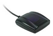
Portable GPS Sensor
The Portable GPS Sensor may be placed near a window and attaches to your PC via a standard USB port.This GPS is powered by the SiRF Star III chipset and is contained in a waterproof enclosure.The included drivers work with Windows 8, Windows 7, Windows Vista, Windows XP, and Windows 2000.SpecificationsGPS Frequency3Cbr />L1 1575.42MHzC/A Code3Cbr />1.023 MHzChannels3Cbr />20 (all in view tracking)Sensitivity3Cbr />-159 dBm (typical)Update Rate3Cbr />1 HzPosition Accuracy3Cbr />Velocity Accuracy3Cbr />0.1 m/sec, SA offTime3Cbr />±100 ns synchronized to GPS timeWAAS and EGNOS Support3Cbr />NoCold Start3Cbr />42 secWarm Start3Cbr />38 secHot Start3Cbr />1 secMax Altitude3Cbr />18,000 m59,000 ftMax Velocity3Cbr />515 m/s1,152 mph1,000 knotsMax Acceleration3Cbr />4 gReacquisition Time3Cbr />0.1 secDatum3Cbr />WGS-84Protocol3Cbr />NMEA 0183 V2.2, 4800 baudNMEA 0183 Sentences3Cbr />GGA, GSA, GSV, RMC, VTGPower3Cbr />80 mAOperating Temperature3Cbr />-40°C to +80°C-40°F to +176°FStorage Temperature3Cbr />-45°C to +85°C-49°F to +185°FOperating Humidity3Cbr />5% to 90% non-condensingAntenna3Cbr />Built-in PatchDimensions3Cbr />56mm x 53mm x 22.5mm2.2 in x 2.08 in x 0.88 inWeight3Cbr />96 g3.38 oz
-
ROSE POINT ECS
Commercial Grade Electronic Charting and Navigation Software for Microsoft Windows ®Rose Point ECS improves operational efficiency, situational awareness, and decision making with straightforward, uncluttered displays and controls that provide instant access to the information you need to navigate safely.Overview What's New Specifications Training Videos SupportNavigationWhen underway, Rose Point ECS provides you with the information you need with a quick glance at its clear, customizable displays and logical controls. Passing Point Predictors indicate where you will meet other vessels in confined waterways, even around bends in a river The Rate of Turn Course Predictor helps reduce over steering by indicating where the vessel will be in the future based on the current speed and rate of turn Advanced AIS support includes closest point of approach calculations and alarms and AIS vessel track saving Fully customizable instrument panels and screen layouts The Voyage Recorder records all navigation data as well as radar, sounder, and video images for playback at a later timeChart CompatibilityRose Point ECS can use the official NOAA ENC® and NOAA RNC® charts directly; there is no need to purchase US charts in a proprietary format. Rose Point ECS even makes it easy to download and install these free charts. Official worldwide charts are available for purchase from Rose Point and other suppliers. Semi-Automatic Chart Updates NOAA ENC® and NOAA RNC® USACE IENC (2.0 and 2.1) S-57 ENC (including S-63 encrypted) Maptech BSB (raster nautical charts) Admiralty Vector Chart Service (AVCS)Additional InformationRose Point ECS provides tightly integrated, easy to use, and completely searchable supplementary navigation information including: Unlimited Routes and Waypoints Boundary Areas with Optional Speed Limits Document file based route and mark organization tools Easy file transfer and printing facilities US Port and Waterway Facilities Guide US Coast Pilot® International Sailing Directions Tide and Current predictions Weather forecasts and observations Gulf of Mexico Lease Block Boundaries Worldwide Gazetteer USACE Hydrographic Surveys NAVTEX message display (required NAVTEX receiver)Sensor Compatibility NMEA 0183 / IEC 61162 and NMEA 2000® GPS, depth, speed, wind, AIS, heading, etc. Configurable port priorities and filtering Sensor offsets for accurate vessel positioning Video Cameras Radar overlay option available+Inland Add-OnThe features of +Inland are ideal for vessels operating on the inland waterways. Mile Markers instead of latitude/longitude Graphical Tow Configuration editor Boat and tow are shown to scale on charts River Stage observations and forecasts
-