010-C0761-10 Bluechart G2 HEU002RDover to Amsterdam & England
Model: 010-C0761-10 Brand: Garmin
British coast: from Scarborough Harbour to Newhaven, including River Thames to London. Continental coast: from Amsterdam to Fecamp See your surroundings more clearly with BlueChart g2 data. With BlueChart g2, you'll get detailed marine cartography that provides convenient viewing of nautical content. BlueChart g2 allows you to see your vessel's precise, on-chart position in relation to naviads, coastal features, anchorages, obstructions, waterways, restricted areas and more. You will also have access to detailed mapping capabilities that include Safety Shading , Fishing Charts , smooth data transition between zoom levels, harmonious transition across chart borders, and reduction of chart discontinuities. « less
Product Specification
-
Universal Product Identifiers
Part Numbers: 010-C0761-10, 10804771, 35595GTIN: 00753759091453
Related Products
-
Pump LA11-12 12V Type 1 Linear Drive Unit
-
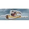
010-00738-00 - Radar Pedestal, 6KW XHD
-
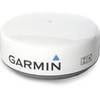
0100057203: GMR 24in HD Marine Radar Dome
-
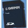
UK/IRE Marine Detail Map G2 Update SD Card
-
WPC074; Penobscot Bay Ed 1
-
MHS125 Two Way VHF Marine Un MHS125 Mobile Equipmen
-
202018 Man Overboard Pole
-
000-10239-001 Zeus Sailing Navigation System - 8" Display
-
3820PF1 Light,Nav(Sold Pair Only)12Vss
-
25ft DB-25(IEEE-1284) Male to Mini/Micro Centronic 36(hpcn36) Male Cable [IE]
-
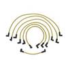
18-8801-1 Premium Marine Spark Plug Wire Leads
-
120-37 Yamaha (Late model) engine I/F