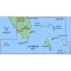
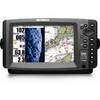
BlueChart g2 Vision - Cape Cod - Maps
Model: Brand: Garmin
BlueChart g2 Vision offers the same rich detailed charting of BlueChart g2 to help you get the most out of your unit. In addition, g2 Vision features a growing database of high-resolution satellite imagery, above and below the water 3D perspective, auto guidance technology, aerial photographs for real world reference and coastal roads with points of interest. This product features Gloucester through New London, including Narragansett Bay, Block Island, Martha's Vineyard, Nantucket Island, the entire Cape, and includes general coverage Georges Bank. « less
Product Specification
-
General
Product Type: MapsDistribution Media: SD Memory CardFirst Seen On Google Shopping: May 2007 -
Compatibility Information
Designed For: Garmin GPSMAP 4008, 4012, 420, 4208, 420s, 4212, 430, 430s, 430sx, 430x, 440, 440s, 440sx, 440x, 450, 5008, 5012, 520, 5208, 520s, 5212, 525, 525s, 530, 530s, 535, 535s, 540, 540s, 545, 545s, 550, 550s, 555, 555s -
Universal Product Identifiers
Part Numbers: 010-C0704-00, Cape CodGTIN: 00097367188502, 00740327805031, 00753759068844
Related Products
-
0100048400 Gmr404,Top Assembly,Antenna
-
NT+ Wide Chart (European Region & Middle East)
-
MapSource BlueChart - Southeast Florida - Maps
-
AIS Dual Channel Synthesised Rcvr SLR-200
-
Electronics Mr F45-D Marine Class-D DSC
-
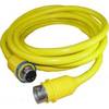
50PC50 50 Amp - 125VAC 50 Foot Cable Cord Set (Yellow)
-
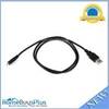
USB 2.0 A Male to Micro-B Male Cable 3 ft.
-
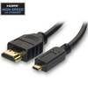
HDMI to Micro HDMI Cable, High Speed with Ethernet, 10 ft
-
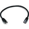
1ft 24AWG Cat5e 350MHz UTP Bare Copper Ethernet Network Cable - Black
-
Phone Cable, RJ12 (6p6c), Reverse - 25ft for voice
-
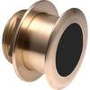
B164-20-BL B164 20 Degree Tilted Element Transducer - Blue Co
-
998c Si Combo NVB Navionics Bundle #407760-1V