MapSource BlueChart - Southeast Florida - Maps
Model: Brand: Garmin
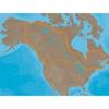
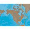
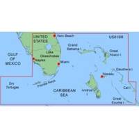
MapSource BlueChart is Garmin's exclusive marine cartography and was developed to provide you with mapping flexibility and options you've never had before. This line of cartography products is designed to provide interactive viewing of detailed nautical chart data, thereby providing navigators with innovative object-oriented cartography. These detailed electronic nautical charts look just like paper charts when displayed on your Garmin chartplotter. Features include shading between depth contours, spot soundings, navaids, port plans, wrecks, obstructions, inter-tidal zones, and more. BlueChart offers much larger coverage areas for half the price. MapSource BlueChart Southeast Florida covers Vero Beach south to include Lake Okeechobee, Florida Keys, Dry Tortugas, and covering the west coast of Florida north to Naples. Also covered all the Bahamas, Andros Island, Eleuthera Island, Cat Island, Great Exuma Island, Little Exuma Island, and Hog Cay. It features data from explorer charts for the Bahamas. « less
Product Specification
-
General
Product Type: MapsDistribution Media: microSD Memory CardFirst Seen On Google Shopping: January 2006 -
Compatibility Information
Designed For: Garmin eTrex Legend Cx, Vista Cx Garmin GPSMAP 60CSx, 60Cx, 76CSx, 76Cx -
Universal Product Identifiers
Part Numbers: 010-C0345-00, Southeast FloridaGTIN: 00753759055745
Related Products
-
MDS-9 4KW 24 Inch Dome Black Box Radar with 10 Meter Cable wmds9
-
Max Lakes Canada C-Card NA-M048
-
NAM033SD Mega Wide Atlantic CST & Carib
-
ACR Pull-Pin Vest Strobe 3961.1
-
Instrument Package for Harley-Davidson Fairing models 2004-2012 - Red LED MCL-3006-R
-
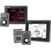
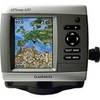
E22115 ST70 Plus Multifunction Instrument Display
-
6ft Premier Series XLR Male to 1/4inch TRS Male 16AWG Cable (Gold Plated)
-
VGA Male to Male Cable 15 ft. CL2
-
Ethernet Category 5 Enhanced RJ45 Network Patch Cable - 3'
-
/ Quicksilver 22-85822T Speedo Tube Connector
-
5266CR 15A 125V 2P 3W SB Plug CR
-
GPSMAP 420 - Marine GPS receiver - 4" color - 240 x 320