010-C1023-20 Bluechart G2 HXEU802XMediterranean Sea & Iberian
Model: 010-C1023-20 Brand: Garmin
NOTE: This preloaded Garmin microSD media is for compatible Garmin units that take microSD memory cards only. This is not for units that require the Garmin proprietary data card. Coverage features the Strait of Gibraltar, the Balearic Islands, the French Riviera, Corsica, Sardinia, Sicily, the Adriatic Sea, the Greek Islands, the Aegean Sea, the Dardanelles and Bosporus Straits, the Sea of Marmara, Cyprus, the Suez Canal, Tripoli and Algiers Harbors, and the Gulfs of Gabes and Tunisia. Also details the Atlantic side of the Iberian Peninsula from the Canary Islands to the Bay of Biscay including the Gulf of Cadiz, the Portugal coast in full, the Gulf of Gascogne, and the Madeira and Azores Islands. « less
Product Specification
-
Universal Product Identifiers
Part Numbers: 010-C1023-20, 10807253, 35817GTIN: 00753759095529
Related Products
-
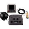
Package(E90W, GPS Antenna, DSM300G Sounder, 4KW 24 Inch Digital Radome & Radar Cable )
-
T52086 RA3048SHD 12KW Super HD Open Array Radar
-
Package(c127 with aus, NZ, S. America, Asia Chart, 4KW 24 Inch Digital Radome & Radar Cable)
-
WPC025; Upper Chesapeake Bay
-
100070500 GHP 10 Marine Autopilot System
-
25ft 24AWG CL2 Standard HDMI Cable - Black
-
6ft USB 2.0 A Male to Micro 5pin Male 28/24AWG Cable w/ Ferrite Core (Gold Plated)
-
10ft 32AWG Mini DisplayPort | Thunderbolt to VGA Cable - White
-
Power Post Dual 2 x 5/16 in. Studs
-
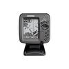
300 Series 365i Combo - Marine Chartplotter - 4" monochrome - 240 x 320
-
1ft 24AWG Cat5e 350MHz UTP Bare Copper Ethernet Network Cable - Yellow
-
Mr HH125 1 Or 3 Watt Handheld VHF Radio CW31385