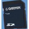
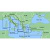
BlueChart g2 - The Nordics - Maps
Model: Brand: Garmin
BlueChart g2 features crisp labeling and an overall smoother presentation on your chartplotter display. In addition to the basic charts, tidal stations, currents, depth contours, IALA symbols and included fishing charts, BlueChart g2 offers improved transitioning between zoom levels and more seamless continuity across chart boundaries. BlueChart g2 also adds safety shading which allows the user to enable contour shading for all depth contours shallower than the user-defined safe depth. The fishing charts are designed to emphasize bathymetric contours with less visual clutter on the display. « less
Product Specification
-
General
Product Type: MapsDistribution Media: SD Memory CardFirst Seen On Google Shopping: November 2011 -
Universal Product Identifiers
Part Numbers: 010-C1021-20, The NordicsGTIN: 00753759095505
Related Products
-
Musician's Gear Bag Black
-
GRH4D HD Ethernet Radar Dome 21" 40381
-
UK/IRE Marine Detail Map G2 Update SD Card
-
MapSource BlueChart - Adriatic Sea, South Coast - Maps
-
NT+ Wide Chart (New Zealand & Australian & Asia Region)
-
Sea Charts of the British Isles: A Voyage of Discovery Around Britain & Ireland's Coastline [Book]
-
1066 Replacement Lithium Battery for 2726 and 2727
-
EC7IF Chartplotter w/Internal Antenna & Fishfinder Tan / Red
-
3ft USB A to Mini-B 5pin 28/28AWG Cable
-
Trailer Wire Adapter 7-Round to 5-Flat Short Lead
-
NavNet 3D Color 12.1" LCD Multifunction Display
-
FishElite 480 - Marine Chartplotter - 5" monochrome - 480 x 480