BlueChart g2 Vision - St. Lawrence Seaway - Maps
Model: Brand: Garmin
BlueChart g2 Vision offers the same rich detailed charting of BlueChart g2 to help you get the most out of your unit. In addition, g2 Vision features a growing database of high-resolution satellite imagery, above and below the water 3D perspective, auto guidance technology, aerial photographs for real world reference and coastal roads with points of interest. This product features the St. Lawrence River from Brockville, Ont. to Sept-Iles, Que., including Montreal and Quebec. Also includes detailed coverage of Lake Champlain and Lac Saint-Jean, including Burlington, VT, Rideau River, the Ottawa River to Temiscaming, the Riviere Saguenay from Chicoutimi, Que. to the St. Lawrence River, and the Hudson River to Troy, NY. « less
Product Specification
-
General
Product Type: MapsDistribution Media: SD Memory CardFirst Seen On Google Shopping: May 2007 -
Compatibility Information
Designed For: Garmin GPSMAP 4008, 4012, 420, 4208, 420s, 4212, 430, 430s, 430sx, 430x, 440, 440s, 440sx, 440x, 450, 5008, 5012, 520, 5208, 520s, 5212, 525, 525s, 530, 530s, 535, 535s, 540, 540s, 545, 545s, 550, 550s, 555, 555s -
Universal Product Identifiers
Part Numbers: 010-C0721-00, St. Lawrence SeawayGTIN: 00753759069018
Related Products
-
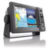
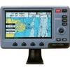
1964CNT NavNet VX2 10.4quot;COLOR Disp 25KW Gearbox
-
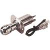
4263121 Chrome Plated Cigarette/Chart
-
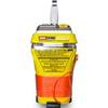
MT-403 AccuSat 406 Cat 2 EPIRB Non-Hazmat Withbracket
-
0493DP999N Cork Gasket
-
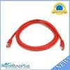
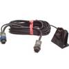
5ft 24AWG Cat5e 350MHz UTP Bare Copper Ethernet Network Cable - Red
-
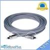
10ft Premium Optical Toslink Cable w/ Metal Fancy Connector
-
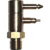
Fuel Line Connector Johnson Evinrude Male Fitting 2-Prong
-
LTD A3030Y50H 50 Amp to 30 Amp Y-Adapter
-
Marine Products Plug Wire Set 9-28043
-
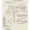
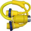
SP-BL Transom Mount Speed Sensor Blue Connector wspbl
-
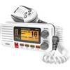
Fixed Mount VHF Marine Radio Whit UN-U*415
-
Colormax Wide Internal Wide 7 Inch Panoramic LCD with Internal