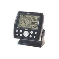
GPS 152 - Marine GPS receiver - 4" monochrome - 100 x 160
Model: 152 Brand: Garmin
The GPS 152 is a 12 parallel channel GPS receiver loaded with a database of American cities and nautical navigation aids such as lights, buoys, sound signals, day beacons and tide data. Built-in memory of one megabyte makes the GPS 152 compatible with Garmin's MapSource Points of Interest CD. With this CD and the GPS 152, you add additional marine navaid detail to your unit. In addition to larger memory, the GPS 152 is compatible with the Wide Area Augmentation System (WAAS), a technology designed to improve the accuracy of GPS positioning to about three meters. On the outside, the GPS 152 comes housed in a waterproof case that's about four inches high and five inches wide. A large four-inch diagonal, high-contrast display features 100x160 pixels for the ultimate in readability. A simple keypad at the bottom of the unit makes entering information easy, without blocking your view of the display. « less
Product Specification
-
General
Product Type: GPS receiverRecommended Use: MarinePreloaded Maps: EuropeReceiver: 12 channelInterface: Serial, NMEA 0183, RTCM SC-104 DGPSFunctions & Services: Bearing, distance, elevation, MOB (Man Overboard), ETA (Estimated Time of Arrival), XTE (Cross Track Error), VMG (Velocity Made Good), speed, time/dateCompatible Software: MapSource Points of InterestGrids: UTM, MGRS, Lat/Lon, UPS, Loran TDs, Maidenhead, QatarSBAS: WAASDGPS: DGPS readyAntenna: Built-inAccuracy: Velocity - 0.16 ft/sec Position - 49 ft Position - 10 ft - 16 ft ( with DGPS ) Position - 10 ft ( with WAAS )Update Rate: 1/secondInternal Memory: 1 MB flashFirst Seen On Google Shopping: April 2004 -
Display
Type: LCD - monochromeDiagonal Size: 4"Resolution: 100 x 160Display Illumination: Yes -
Acquisition Times
Warm: 15 secCold: 45 sec -
Navigation
Waypoints: 500Tracklog Points: 2048Routes: 20Waypoints per route: 30Trip Computer: TracBack, average speed, maximum speed, trip timer, trip distance, sunrise/sunset times -
Miscellaneous
Protection: WaterproofWaterproof Standard: IPX7Included Accessories: Mounting bracket, power/data cable -
Dimensions & Weight
Width: 5.3 inDepth: 2.4 inHeight: 4.9 inWeight: 16 oz -
Environmental Parameters
Min Operating Temperature: 5 °FMax Operating Temperature: 158 °F -
Universal Product Identifiers
Part Numbers: 010-00227-20, 010-00227-30, 152GTIN: 00753759042653
Related Products
-
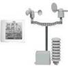
NG Weather 265NNC Touch Screen Weather Station
-
IR2 4.4 4KW 4.5 Foot Open Array Radar R-0006
-
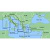
MapSource BlueChart - Adriatic Sea, North Coast - Maps
-
Waterproof Chart Kit - South Shore Long Island #WPB0340-02
-
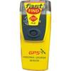
Fast Find 220 Personal Locator Beacon (PLB)
-
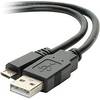
USB 2.0 A Male to Micro-B Male Cable 1.5 ft.
-
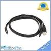
3ft eSATA + USB to Esatap Cable - Black
-
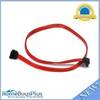
0.5meter SATA Serial ATA Cable (90 Degree - Right Angle)
-
NavNet 3D Color 12.1" LCD Multifunction Display
-
Marine Products Plug Wire Set, Mercruiser V-8, 9-28000
-
18-4461 Brass Connector
-
000-10530-001 HDS-7 Gen2 Insight USA 83200khz Marine Electronics