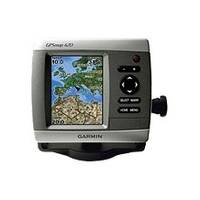
GPSMAP 420s - Marine GPS receiver - 4" color - 240 x 320
Model: 420s Brand: Garmin
The GPSMAP 420s is a sleek, space-saving chartplotter that features an ultra-bright 4" QVGA display, built-in satellite-enhanced worldwide basemap, and simplified user operation. The 420s also has an SD card slot so you can add additional features with the optional BlueChart g2 Vision card. The 420s's basemap contains worldwide satellite images in place of more traditional maps, and its SD card slot makes it easy to add additional maps without connecting to a computer. With fewer keys and a simple, intuitive interface, the 420s makes navigating your way through the water easy. The GPSMAP 420s comes with a powerful dual frequency transducer that clearly paints depth contours, fish targets and structure whether you're fishing in fresh water or off the coast. The 420s is also CANet compatible, so you can share sounder data with another chartplotter on your boat. « less
Product Specification
-
General
Product Type: GPS receiverRecommended Use: MarinePreloaded Maps: Ireland, United KingdomReceiver: 12 channelCard Reader: SD Memory CardInterface: NMEA 0183Functions & Services: MOB (Man Overboard)Compatible Software: BlueChart g2 VisionGrids: UTM, Lat/Lon, UPS, Loran TDs, MaidenheadSBAS: WAASDGPS: DGPS readyAntenna: Built-inAccuracy: Position - 49 ft Velocity - 0.16 ft/sec Position - 10 ft ( with WAAS )Update Rate: 1/secondFeatures: Optional external GPS antenna connection, alarm, 2D / 3D map perspectiveFirst Seen On Google Shopping: April 2007 -
Display
Type: LCD - colorDiagonal Size: 4"Resolution: 240 x 320 -
Acquisition Times
Warm: 15 secCold: 45 sec -
Navigation
Waypoints: 1500Tracks: 20Tracklog Points: 10000Routes: 20Trip Computer: TracBack, sunrise/sunset times, sun/moon positions -
Connections
Interfaces: Antenna -
Miscellaneous
Body Material: ABS plasticDesign Features: Rugged caseProtection: WaterproofWaterproof Standard: IPX7Included Accessories: Protective cover, mounting bracket, power/data cable -
Dimensions & Weight
Width: 5.7 inDepth: 2.7 inHeight: 5 inWeight: 1.3 lbs -
Environmental Parameters
Min Operating Temperature: 5 °FMax Operating Temperature: 131 °F -
Universal Product Identifiers
Part Numbers: 010-00516-22, 010-00516-24, 420sGTIN: 00753759065805
Related Products
-
408470-1 581i Di Combo Fishfinder
-
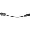
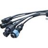
Sonar Ready Adaptor Cables
-
T70046 E95 Multifunction Display w/US Inland Charts
-
City Navigator North America NT 2012 Map Card Microsd/sd 010-11551-00 c38854
-
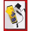
1067 Replacement Nicad Battery for 2726 and 2727
-
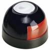
Series 22 Navigation Lights Deck Mount, Red, 1/4" x 1/8"
-
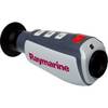
E70032 TH24 240 x 180 Thermal Marine Scope
-
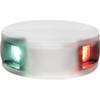
LED Bicolor Light White 12V
-
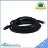
15ft 24AWG CL2 High Speed HDMI Cable w/ Net Jacket - Black
-
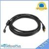
15ft USB 2.0 A Male to Micro 5pin Male 28/24AWG Cable w/ Ferrite Core (Gold Plated)
-
1852068 MKR-US2-8 Hum 7 Pin Connector
-
18-8804-1 Premium Marine Spark Plug Wire Leads