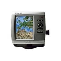
GPSMAP 520s - Marine GPS receiver - 5" color - 240 x 320
Model: 520s Brand: Garmin
This slim-line chartplotter flush-mounts easily in your boat and boasts an ultra-bright 5" QVGA display. The GPSMAP 520s also sports a built-in satellite-enhanced worldwide basemap and simple, straightforward buttons and menus. You can add the optional BlueChart g2 Vision SD card for even more enhanced features. With just a few buttons and a simple, intuitive interface, the GPSMAP 520s makes navigating virtually effortless. And instead of a traditional basemap, the 520s has a basemap of worldwide satellite images. It also has an SD card slot so you can add additional detailed maps without connecting to a computer. The GPSMAP 520s comes with a powerful dual frequency transducer that clearly paints depth contours, fish targets and structure whether you're fishing in fresh water or off the coast. The 520s is also CANet compatible, so you can share sounder data with another chartplotter on your boat. « less
Product Specification
-
General
Product Type: GPS receiverRecommended Use: MarineReceiver: 12 channelCard Reader: SD Memory CardInterface: NMEA 0183Compatible Software: BlueChart g2 VisionSBAS: WAASDGPS: DGPS readyAntenna: Built-inAccuracy: Position - 49 ft Velocity - 0.16 ft/sec Position - 10 ft ( with WAAS )Update Rate: 1/secondFeatures: Optional external GPS antenna connection, alarm, 2D / 3D map perspectiveFirst Seen On Google Shopping: April 2007 -
Display
Type: LCD - colorDiagonal Size: 5"Resolution: 240 x 320Features: Adjustable brightness -
Acquisition Times
Warm: 15 secCold: 45 sec -
Navigation
Waypoints: 1500Tracks: 20Tracklog Points: 10000Routes: 20Trip Computer: Sunrise/sunset times, sun/moon positions -
Connections
Interfaces: Antenna -
Miscellaneous
Design Features: Rugged caseProtection: WaterproofWaterproof Standard: IPX7Included Accessories: Protective cover, mounting bracket, power/data cable -
Dimensions & Weight
Width: 5.9 inDepth: 2.9 inHeight: 6.4 inWeight: 1.8 lbs -
Environmental Parameters
Min Operating Temperature: 5 °FMax Operating Temperature: 131 °F -
Universal Product Identifiers
Part Numbers: 010-00611-00, 010-00611-01, 520sGTIN: 00753759065928
Related Products
-
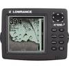
X126DF Dual Frequency Sonar 117-08
-
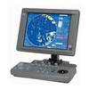
JMA-5106 Black Box Radar 72NM, 6KW with 4 Foot Open Array without Display
-
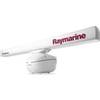
T52087 4KW 72quot; Open Array Super HD W/15M Cable
-
BlueChart g2 Vision - Southeast Caribbean - Maps
-
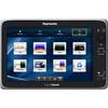
E70025 e165 15.4" Multifunction Display - Charts Not in
-
010-C0730-10 Bluechart G2 HUS029RSouthern Bahamas Data Card
-
Shore Power Cable 6/4 Yellow Per/Ft
-
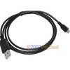
3ft USB 2.0 A Male to Micro 5pin Male 28/24AWG Cable w/ Ferrite Core (Gold Plated)
-
Serial cable - (DB-9) - F - 10 ft - PC
-
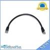
1ft 24AWG Cat6 550mhz UTP Ethernet Bare Copper Network Cable - Black
-
lian M2-TD02 I-Series Dish Network Multi-Satellite Interface Mult
-
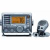
M504 Grey VHF Radio