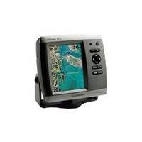
GPSMAP 525 - Marine GPS receiver - 5" color - 640 x 480
Model: 525 Brand: Garmin
This chartplotter provides the brightest, sharpest, most colorful graphics you've ever seen on a 5-inch screen. See clearly as you navigate with the 525's crisp, sunlight-readable VGA display driven by a high-speed processor. This chartplotter offers exceptional detail, fast redraw rates, and the most realistic photo-enhanced cartography ever seen in this class of fixed-mount electronics. The 525's worldwide basemap can be enhanced with the optional BlueChart g2 Vision card, which provides high-resolution aerial reference photos for help navigating tricky harbors and channels - or locating spots like area marinas, fuel stops or restaurants. The g2 Vision plug-in SD data card also allows the GPSMAP 525 to graphically depict a true 3D "mariner's eye" topside view or "fish eye" underwater navigation perspective. With fewer buttons to push and fewer operational steps to navigate, the GPSMAP 525's simplified menu format makes it easy for you to see and select the data you want to access on-screen. « less
Product Specification
-
General
Product Type: GPS receiverRecommended Use: MarineReceiver: 12 channelCard Reader: SD Memory CardInterface: NMEA 0183Included Software: Garmin Worldwide Marine BasemapCompatible Software: BlueChart g2 VisionSBAS: WAASDGPS: DGPS readyAntenna: Built-inAccuracy: Position - 49 ft Velocity - 0.16 ft/sec Position - 10 ft ( with WAAS )Update Rate: 1/secondFeatures: Optional external GPS antenna connectionFirst Seen On Google Shopping: February 2007 -
Display
Type: LCD - colorDiagonal Size: 5"Resolution: 640 x 480Features: Adjustable brightness -
Acquisition Times
Warm: 15 secCold: 45 sec -
Navigation
Waypoints: 1500Tracklog Points: 10000Routes: 20 -
Connections
Interfaces: Antenna -
Miscellaneous
Design Features: Rugged caseProtection: WaterproofWaterproof Standard: IPX7Included Accessories: Protective cover, mounting bracket -
Dimensions & Weight
Width: 5.9 inDepth: 2.9 inHeight: 6.4 inWeight: 1.8 lbs -
Environmental Parameters
Min Operating Temperature: 5 °FMax Operating Temperature: 131 °F -
Universal Product Identifiers
Part Numbers: 010-00597-00, 525GTIN: 00753759066116
Related Products
-
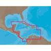
NA-C502 Furuno FP Format Western Caribbean S
-
D232 Imray Curacao Marine Nautical Chart
-
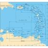
BlueChart g2 Vision - Hawaiian Is. - Mariana Is. - Maps
-
Cat6a Ethernet Cable | 5ft | Orange | Network | 10 Gigabit
-
Bulk cable - CAT 6 - Unshielded twisted pair (UTP) 1000 ft - White
-
30 Amp 50' Cord Set - White - 125V
-
100ft 12AWG CL2 Rated 2-Conductor Loud Speaker Cable (for In-Wall Installation)
-
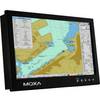
MD-124X 24 Inches Marine Display with 16:9 Aspect Ratio. Full HD (1920x108
-
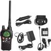
NT3VP Nautico Waterproof Marine Radio mdlnt3vp
-
2708 Cover for 600 Amp Cable Connector
-
Connector,Trailer TC43624
-
DSM300G Network Sounder Module F/ C & E & G E63069G