MapSource BlueChart - Hong Kong/South China Sea - Maps
Model: Brand: Garmin
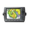
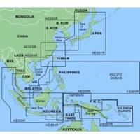
MapSource BlueChart is Garmin's exclusive marine cartography and was developed to provide you with mapping flexibility and options you've never had before. This line of cartography products is designed to provide interactive viewing of detailed nautical chart data, thereby providing navigators with innovative object-oriented cartography. These detailed electronic nautical charts look just like paper charts when displayed on your Garmin chartplotter. Features include shading between depth contours, spot soundings, navaids, port plans, wrecks, obstructions, inter-tidal zones, and more. BlueChart offers much larger coverage areas for half the price. MapSource BlueChart Hong Kong/South China Sea offers general coverage of the coasts of the Malay Peninsula, Thailand, Cambodia, Vietnam, and China east to Quanzhou, including Hainan Island and Macau. Included in this overall general coverage are numerous detailed charts covering areas such as Phuket, Thai., George Town, Mal., Singapore, Ho Chi Minh City, Viet., Guangzhou, Chin., Hong Kong, and Xiamen, Chin. « less
Product Specification
-
General
Product Type: MapsDistribution Media: Garmin Data CardFirst Seen On Google Shopping: January 2006 -
Compatibility Information
Designed For: Garmin GPSMap 172C, 176, 176C, 178C, 178C Sounder, 182, 182C, 188 Sounder, 188C Sounder, 196, 2006, 2006C, 2010, 2010C, 2106C, 2110C, 2206C, 2210C, 232, 238 Sounder, 276C, 292C, 296, 298C, 3006C, 3010c, 3205C, 3206C, 3210C, 376C, 392C, 396C, 492C, 498C -
Universal Product Identifiers
Part Numbers: 010-C0145-00, Hong Kong/South China Sea
Related Products
-
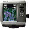
0100077300 Gpsmap536 Plotter
-
T70047 E97 Multifunction Display w/Sonar - US Inland Charts
-
C97 Multifunction 9" Display with Sonar - US Coastal Charts T70021 c44326
-
NT+ Wide Chart (New Zealand & Australian & Asia Region)
-
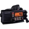
Standard - Gx5000S - Quantum, Hailer, Rem CON, BLUETOOTH, Blk
-
Cat6a Ethernet Cable | 3ft | Red | Network | 10 Gigabit
-
USB 3.0 Micro Cable | 6ft | Type A | Micro Type B | Black
-
7ft 24AWG Cat5e 350MHz UTP Bare Copper Ethernet Network Cable - Orange
-
B260-6N 1kW Thru-Hull Transducer Navico 6-Pin Connector
-
P32-200-VDO 250W 200kHz Transom Mount Triducer VDO No Connector
-
Parts Express Marine Grade Locking Cigarette Lighter Plug 12 VDC
-
GPSMAP 3010c - Marine GPS receiver - 10.4" color - 640 x 480