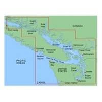
MapSource BlueChart - Puget Sound to Port Hardy - Maps
Model: Brand: Garmin
MapSource BlueChart is Garmin's exclusive marine cartography and was developed to provide you with mapping flexibility and options you've never had before. This line of cartography products is designed to provide interactive viewing of detailed nautical chart data, thereby providing navigators with innovative object-oriented cartography. These detailed electronic nautical charts look just like paper charts when displayed on your Garmin chartplotter. Features include shading between depth contours, spot soundings, navaids, port plans, wrecks, obstructions, inter-tidal zones, and more. BlueChart offers much larger coverage areas for half the price. MapSource BlueChart Puget Sound to Port Hardy offers detailed coverage from Puget Sound through the Strait of Georgia and Queen Charlotte Strait to Port Hardy, BC, including Olympia, WA, Seattle, WA, Victoria, BC, Desolation Sound, BC and Vancouver, BC. Primarily general coverage of the southern portion of Victoria Island and northwest corner of Washington state from Grays Harbor, WA to Barkley Sound, BC. Included in this overall general coverage are a number of detailed charts covering areas such as Westport, WA, Neah Bay, WA, and Ucluelet, BC and the Fraser River. « less
Product Specification
-
General
Product Type: MapsDistribution Media: Garmin Data CardFirst Seen On Google Shopping: January 2006 -
Compatibility Information
Designed For: Garmin GPSMap 172C, 176, 176C, 178C, 178C Sounder, 182, 182C, 188 Sounder, 188C Sounder, 196, 2006, 2006C, 2010, 2010C, 2106C, 2110C, 2206C, 2210C, 232, 238 Sounder, 276C, 292C, 296, 298C, 3006C, 3010c, 3205C, 3206C, 3210C, 376C, 392C, 396C, 492C, 498C -
Universal Product Identifiers
Part Numbers: 010-C0012-00, Puget Sound to Port HardyGTIN: 00753759041175
Related Products
-
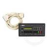
10' Network Cable for Scp Remote Panel 809-0938
-
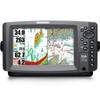
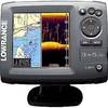
958c Combo 36983
-
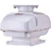
RSB0073-085 24/48 rpm Gearbox with 6.0 KW Transceiver (FR8062)
-
010-C0763-10 Bluechart G2 HEU004RIrish Sea Data Card
-
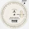
105 Marine Navigation Nautical Slide Rule
-
Elite-5 DSi Gold Color DownScan Combo Unit
-
Cat6a Ethernet Cable | 5ft | Red | Network | 10 Gigabit
-
25ft 24AWG CL2 Standard HDMI Cable - White
-
6ft 28AWG VGA USB (A Type) to M1-D (pd) Cable - Black
-
AS GR16 - Marine GPS receiver
-
Electronics - MRF80B-D - MR-F80BD Marine Radio for Marine
-
Lumishore THX72-CCP-FF Thru-Hull Flush Fit Color Change Underwater Lig