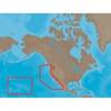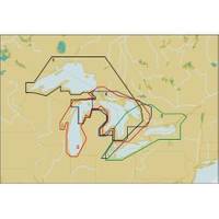
Michigan, Huron, No. Chann. & Georgian Bay: NT+ Wide Coverage by C-Map
Mfr: C-MAP Electronic Charts - NA-C102; C-Map NT+ Electronic Charts to navigate the Great Lakes of North America give you ideal coverage for trips of any lengths with detailed information to make your cruise safer & more enjoyable. NT+ electronic charts are reverse compatible with NT charting systems but with four times the coverage. C-Map creates their object oriented NT+ charts from official paper charts & adds features paper chart can't match. NT+ chart technology brings you object oriented, vector charts faithfully reproduced from official paper charts but with information and capabilities paper charts cannot provide. NT+ charts include all the information of raster & simple vector charts without data dilution or and no odd scaling. These charts provide seamless coverage allowing smooth panning between coverage layers of any given navigation area. Guardian signals an alarm if you boat enters the predetermined area so you can be on the look out. NT+ charts give you North-up or Chart-up view options. The NavAids are presented in detailed, true color paper chart appearance. C-MAP Electronic charts are produced using official Hydrographic Office (HO) charts under the controls of ISO 9002 certified quality system. They are accurate to the best of C-Map's knowledge and any inconsistencies found are generally due to undetectable limitations in the HO charts themselves. Where due, Royalty Charges are included in C-CARD prices and paid to National Hydrographic Authorities. « less
Product Specification
-
Universal Product Identifiers
Part Number: NA-C102
Related Products
-
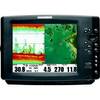
1158C HD Combo 407980-1
-
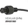
8M4001960 Tour Series Sonar Adapter Vexilar 3 Pin
-
NA-M024 SD Card Format US West Coast and Haw
-
Marinenav Explorer Marine Navigation PC Computer EXP-013-AMD
-
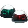
5040SS1 Stainless Pulsar Nav. Lights
-
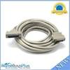
25ft DB-25(IEEE-1284) Male to Mini/Micro Centronic 36(hpcn36) Male Cable [IE]
-
Whisper 100/200 Charge Controller
-
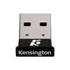
Kensington Bluetooth USB Micro Adapter Network adapter - USB
-
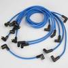
Marine Products Plug Wire Set 9-28021
-
DSM30 Digital Network Sounder Module E63074
-
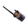
VHF Handheld Radio Black (151-ICM88)
-
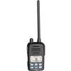
VOYAGER VHF Two-way radio