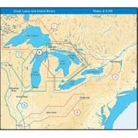
NT+ Wide Map, Lake Huron/Georgian Bay/North Channel NA-C104
Model: NA-C104 Brand: C-Map
C-MAP has set the standard for electronic charts with five consecutive NMEA awards for "Best Electronic Cartography". Built on the incredible success of C-MAP NT+, NT+ Wide combines a generation of chartplotters with efficient performance plus real-time accuracy and detail. Now you will be able to see slip detail as well as the locations for onshore facilities. « less
Product Specification
-
Universal Product Identifiers
Part Number: NA-C104GTIN: 00686074003071
Related Products
-
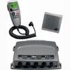
Package(E140W, GPS Antenna, DSM300G Sounder, RA1072HD 4KW 72 Inch HD Digital Open Array Radar & 15m Radar Cable )
-
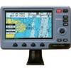
010-00756-01 VHF 300i Marine Radio
-
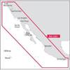
NA-C601 Acapulco, Mexico to Cape Flattery
-
010-C0879-20 Bluechart G2 HXAE004RHong Kong/South China Sea
-
BlueChart g2 Vision - North Maine - Maps
-
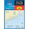
Waterproof Chart Book - Casco Bay to Camden 35266
-
Fastfind 210 - GPS Personal Locator Beacon, -40C Battery F/ Fastfind
-
LED Stern Transom Mount Black ASL-335027
-
Dlx. Radar Reflector W/Case,Harness
-
Hook & Loop Fastening Cable Ties 6inch, 100pcs/Pack - Black
-
Drain Plug Black
-
Colormax Wide Internal Wide 7 Inch Panoramic LCD with Internal