Paper Chart Kit Book REGION03 New York to Nantucket
Model: REGION03 Brand: Maptech
Completely updated. Coastal and offshore coverage. Full-color charts, GPS waypoints, courses and distances, Yeoman points, and color aerial photos. Save hundreds of dollars on charts. 22 X 17, 90 chart pages. Product Overview New features make ChartKits easy to use with your GPS. Most charts include one-minute lat./long. grids to make vessel positioning a breeze, and major navigation aids are identified with named GPS waypoints. GPS Ready New features make ChartKits easy to use with your GPS. Most charts include one-minute lat./long. grids to make vessel positioning a breeze, and major navigation aids are identified with named GPS waypoints. Small and Large Scale Charts ChartKits include small-scale, wide area charts as well as large-scale, detailed charts of harbors and approaches. « less
Product Specification
-
Universal Product Identifiers
Part Number: PAPREGION03
Related Products
-
1440 Handi-Mate O.B. Handle
-
The Nautical Chart - 11 x 17 Movie Poster - Spanish Style A
-
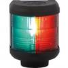
Navigation Light Bi Color
-
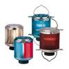
Series 50 Classic Stainless Steel Navigation Lights
-
Bulk cable - Fiber optic 1000 ft
-
3ft 28AWG DVI-A to SVGA (HD15) Cable - Black
-
Serial cable - (DB-37) - M - (DB-37) - F - 6 ft - PC
-
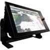
NavNet TZtouch TZT14 14.1" Multifunction Display
-
CPA-123 Cell Phone Adapter Cable
-
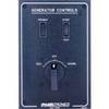
Paneltronics 9982301B Standard 120/220V AC Ship to Shore Selector
-
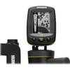
Fishin' Buddy 130 - Fishfinder - portable - included transducer - single-beam
-
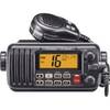
M412 12 Fixed-Mount 25W VHF Marine Radio with Class D DSC (W