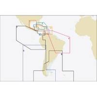
Puerto Bolivar to Rio de Janeiro: NT+ Wide Coverage by C-Map
Mfr: C-MAP Electronic Charts - SA-C004; C-Map NT+ Electronic Navigation Charts Central & South America give you ideal coverage for trips of all lengths. The detailed information makes your cruise safer & more enjoyable. NT+ charts use C-Map's Guardian Technology that scans the chart area you choose in front of your vessel & sets off an alarm if you come upon shoals, rocks, sand spits or other areas that pose a threat to you & your boat. NT+ electronic charts are reverse compatible with NT charting systems but with four times the coverage. C-Map creates their object oriented NT+ charts from official paper charts & adds features paper chart can't match. C-Map includes all the information from the raster & simple vector charts without dilution or any manipulation of the data and with no odd scaling. NT+ charts provide seamless coverage allowing smooth panning between all coverage layers of any given navigation area. NT+ charts include C-Map's Guardian Technology. You set up Guardian to suit your needs. NT+ Charts provide tidal information for primary tidal stations worldwide & secondary tidal stations in the U.S. NT+ charts give you North-up or Chart-up view options. The NavAids are presented in detailed, true color paper chart appearance. They are accurate to the best of C-Map's knowledge and any inconsistencies found are generally due to undetectable limitations in the HO charts themselves. Where due, Royalty Charges are included in C-CARD prices and paid to National Hydrographic Authorities. « less
Product Specification
-
Universal Product Identifiers
Part Number: SA-C004
Related Products
-
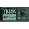
22084578 AP20 Second Station
-
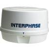
Mini RE-1 Radar engine 2KW 24km 11" Dome (No Display Included)
-
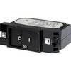
7404 20A Flat Rocker Circuit Breaker SC1
-
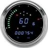
2000 Series Tank Mount Instrument Replacement - 4-1/2 Inch Speedometer/Tachometer with Direct ECM Plug-in for Harley Davidson Road King/Softail 1996-2003 - Blue Display - MCL-2002
-
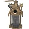
Flushing Strainer, 1 Inch
-
Hook & Loop Fastening Cable Ties 9inch, 100pcs/Pack - Black
-
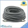
100ft Premium Optical Toslink Cable w/ Metal Fancy Connector
-
2205 Black Terminal Feed Through Connector
-
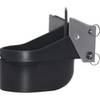
TM260-8F 1kW 50/200 kHz Transom Mount Transducer 8F Connector
-
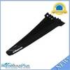
Whisper 70' Guyed Tower Kit (Whisper 500) (does Not Include Pipe & Anchors)
-
As-Interlink Network Connection c28858
-
E62190-US - A70 6.4 Chartplotter, US Maps, Int GPS