The Sea Chart: An Historical Survey Based on the Collections in the National Maritime Museum [Book]
Product Specification
-
Authors: Derek Howse, Michael W. B. SandersonPages: 144Format: bookPublication Date: 1973
-
Universal Product Identifiers
ISBN: 0070306028GTIN: 09780070306028
Related Products
-
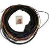
Boat (External) Wiring Harness Johnson/Evinrude OMC Green Plug New 473-9440 Instrument Cable Assembly
-
Admiral P2 Color Display, SSRC1 Rate Gyro Compass, No Feedback
-
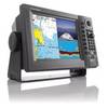
NavNet 1934C NT VX2 10.4 Inch 4KW 48NM Radar System with 3.5' Open Array c16826
-
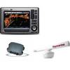
Package(E90W, GPS Antenna, DSM300G Sounder, RA1072HD 4KW 72 Inch HD Digital Open Array Radar & 15m Radar Cable )
-
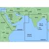
MapSource BlueChart - The Gulf and Red Sea - Maps
-
NA-C230 Furuno FP Format - Gulf of St. Lawrence
-
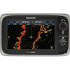
T70007 e7D 7" Multifunction w/Sonar, Internal GPS - Row
-
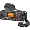
gb0534 Full-featured Fixed Mount VHF Marine Radio-Black
-
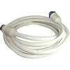
50 Amp 25' Cord Set - White - 125/250V
-
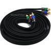
12ft 18AWG CL2 Premium 3-RCA Component Video Coaxial Cable
-
5ft 24AWG Cat6 550mhz UTP Ethernet Bare Copper Network Cable - Yellow
-
E62354 E7 7" Multifunction Display w/Internal GPS - No