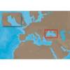
010-C0774-10 Bluechart G2 HEU016RMediterranean Southeast Data
Model: 010-C0774-10 Brand: Garmin
See your surroundings more clearly with BlueChart g2 data. With BlueChart g2, you'll get detailed marine cartography that provides convenient viewing of nautical content. BlueChart g2 allows you to see your vessel's precise, on-chart position in relation to naviads, coastal features, anchorages, obstructions, waterways, restricted areas and more. You will also have access to detailed mapping capabilities that include Safety Shading, Fishing Charts, smooth data transition between zoom levels, harmonious transition across chart borders, and reduction of chart discontinuities. Covers: From Gulluk, Turkey east to include Cyprus, Syria, Lebanon and Israel, then west to Misratah, Libya. « less
Product Specification
-
Universal Product Identifiers
Part Numbers: 010-C0774-10, 10805075, 35621GTIN: 00753759091712
Related Products
-
AP2403VRF Autopilot AP24,AC12,RC42,RPU80
-
120-2580-01 Shadow Drive for Verado Autopilot
-
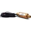
MDS-8 Radar Sensor 2KW 20 Dome 1/8-24NM
-
EM-C102 C-Card Format - Black Sea & Marmara
-
010-C0730-10 Bluechart G2 HUS029RSouthern Bahamas Data Card
-
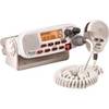
RADIO-FIX VHF Class-D DSC Wht
-
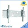
Adjustable Tilting Wall Mount Bracket for LCD LED Plasma (Max 165Lbs, 30~63inch) - Silver (No Logo)
-
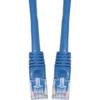
Cat6a Ethernet Cable | 3ft | Blue | Network | 10 Gigabit
-
70 Starboard Nav Light
-
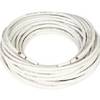
20ft 24AWG CL2 Standard HDMI Cable - White
-
Mount 4079 1m RG58 W PL259 Connector
-
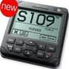
GPSMAP 421 - Marine Chartplotter - 4" color - 240 x 320