BlueChart g2 Vision - Bretagne - Maps
Model: Brand: Garmin
BlueChart g2 Vision offers the same rich detailed charting of BlueChart g2 to help you get the most out of your unit. In addition, g2 Vision features a growing database of high-resolution satellite imagery, above and below the water 3D perspective, auto guidance technology, aerial photographs for real world reference and coastal roads with points of interest. This product features detailed coverage from Saint-Vaast-la-Hougue to Le Croisic and Belle-Ile, including Cherbourg, the Channel Islands, Saint-Malo, Brest, and Lorient. « less
Product Specification
-
General
Product Type: MapsDistribution Media: SD Memory CardFirst Seen On Google Shopping: June 2007 -
Compatibility Information
Designed For: Garmin GPSMAP 4008, 4012, 420, 4208, 420s, 4212, 430, 430s, 430sx, 430x, 440, 440s, 440sx, 440x, 450, 5008, 5012, 520, 5208, 520s, 5212, 525, 525s, 530, 530s, 535, 535s, 540, 540s, 545, 545s, 550, 550s, 555, 555s -
Universal Product Identifiers
Part Numbers: 010-C0801-00, BretagneGTIN: 00753759069810
Related Products
-
Magnifier Chart Weight, Brass
-
Waterproof Chart Kit - San Juan Islands #WPB1510-02
-
BlueChart g2 Vision - Hecate Strait South - Maps
-
Max Wide International cwidei
-
Cat6a Ethernet Cable | 10ft | Gray | Network | 10 Gigabit
-
68362P Amega 4-Gauge Set (SpeedTachFuelVolt)
-
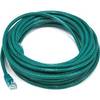
25ft 24AWG Cat5e 350MHz UTP Bare Copper Ethernet Network Cable - Green
-
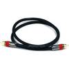
240-182 Digital Coaxial/Subwoofer Audio Cable 3 ft. CL2
-
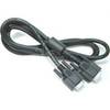
DVI or VGA Interconnect Cable to (digital) 10M
-
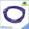
10ft 28AWG High Speed HDMI Cable w/Ferrite cores - Purple
-
Circle Cable Clips with Steel Nail, 40mm, 50pcs/Pack
-
FA58976-1 - Connector assy , NLA Mercury Marine