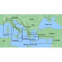
MapSource BlueChart - Adriatic Sea, South Coast - Maps
Model: Brand: Garmin
MapSource BlueChart is Garmin's exclusive marine cartography and was developed to provide you with mapping flexibility and options you've never had before. This line of cartography products is designed to provide interactive viewing of detailed nautical chart data, thereby providing navigators with innovative object-oriented cartography. These detailed electronic nautical charts look just like paper charts when displayed on your Garmin chartplotter. Features include shading between depth contours, spot soundings, navaids, port plans, wrecks, obstructions, inter-tidal zones, and more. BlueChart offers much larger coverage areas for half the price. MapSource BlueChart Adriatic Sea, South Coast provides detailed coverage of Italian coast from Porto Civitanova to extend south to Siracusa, Sicilia. From Split, Croatia to Killini, Greece. « less
Product Specification
-
General
Product Type: MapsDistribution Media: Garmin Data CardFirst Seen On Google Shopping: January 2006 -
Compatibility Information
Designed For: Garmin GPSMap 172C, 176, 176C, 178C, 178C Sounder, 182, 182C, 188 Sounder, 188C Sounder, 196, 2006, 2006C, 2010, 2010C, 2106C, 2110C, 2206C, 2210C, 232, 238 Sounder, 276C, 292C, 296, 298C, 3006C, 3010c, 3205C, 3206C, 3210C, 376C, 392C, 396C, 492C, 498C -
Universal Product Identifiers
Part Numbers: 010-C0107-00, Adriatic Sea, South Coast
Related Products
-
29035 GMR 18 / 4 KW Digital Marine Radar Scanner
-
4KW 48" HD Digital Open Array Radar
-
Canada g2 - Maps
-
TS200-30 Temperature Probe f/SST-110 Thru-Hull
-
Hydrographical Surveying: A Description of the Means and Methods Employed in Construcing Marine Charts [Book]
-
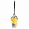
Smartfind E5 EPIRB - Auto Float Free - Yellow/White 29951
-
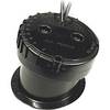
49450200Es InHull Transducer
-
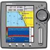
EC5EF 5 Inch GPS Chartplotter Fishfinder Combo External Antenna
-
Patch cable - CAT 5e - RJ-45 - M - Shielded twisted pair (STP) 100 ft - Gray
-
10ft 28AWG High Speed HDMI Cable w/Ferrite cores - Yellow
-
CA50/200 12M HIGH-PERFORMANCE Bronze Thru-Hull Transducer
-
Air Breeze 1-ARBM-15-48 Marine Wind Generator 48VDC